MyTopo
Ireton SW Iowa US Topo Map
Couldn't load pickup availability
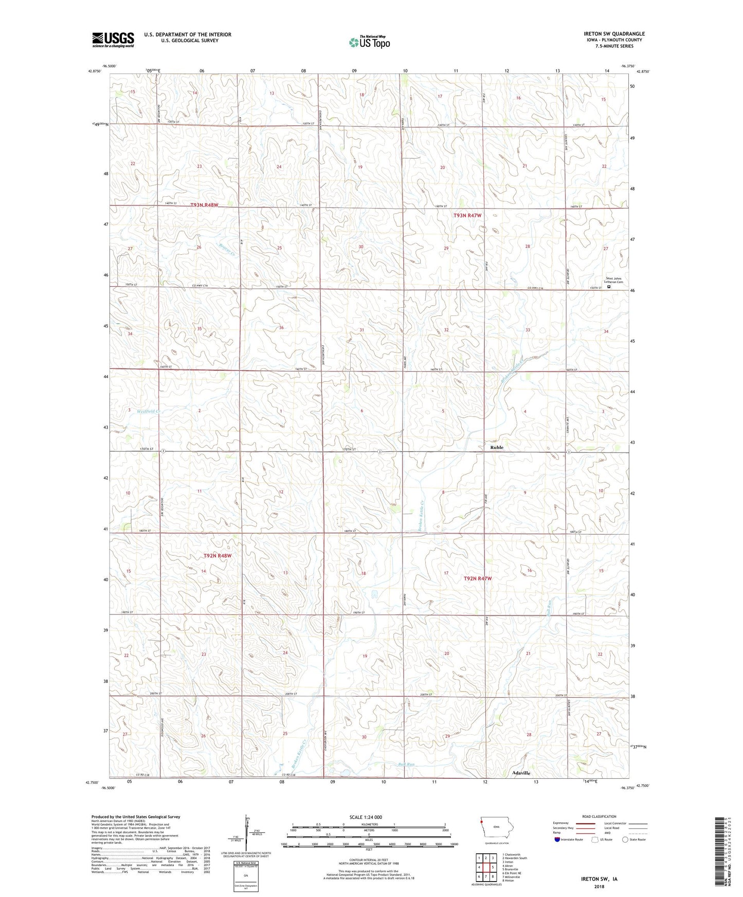
2022 topographic map quadrangle Ireton SW in the state of Iowa. Scale: 1:24000. Based on the newly updated USGS 7.5' US Topo map series, this map is in the following counties: Plymouth. The map contains contour data, water features, and other items you are used to seeing on USGS maps, but also has updated roads and other features. This is the next generation of topographic maps. Printed on high-quality waterproof paper with UV fade-resistant inks.
Quads adjacent to this one:
West: Akron
North: Hawarden South
Northeast: Ireton
East: Brunsville
Southeast: Hinton
South: Millnerville
Southwest: Elk Point NE
This map covers the same area as the classic USGS quad with code o42096g4.
Contains the following named places: Adaville, Adaville Post Office, Bull Run, Furay Post Office, Ponona Post Office, Ruble, Ruble Post Office, Saint Johns Church, Saint Johns Lutheran Cemetery, Township of Johnson, Township of Preston, Winter Feedlot