MyTopo
Millnerville Iowa US Topo Map
Couldn't load pickup availability
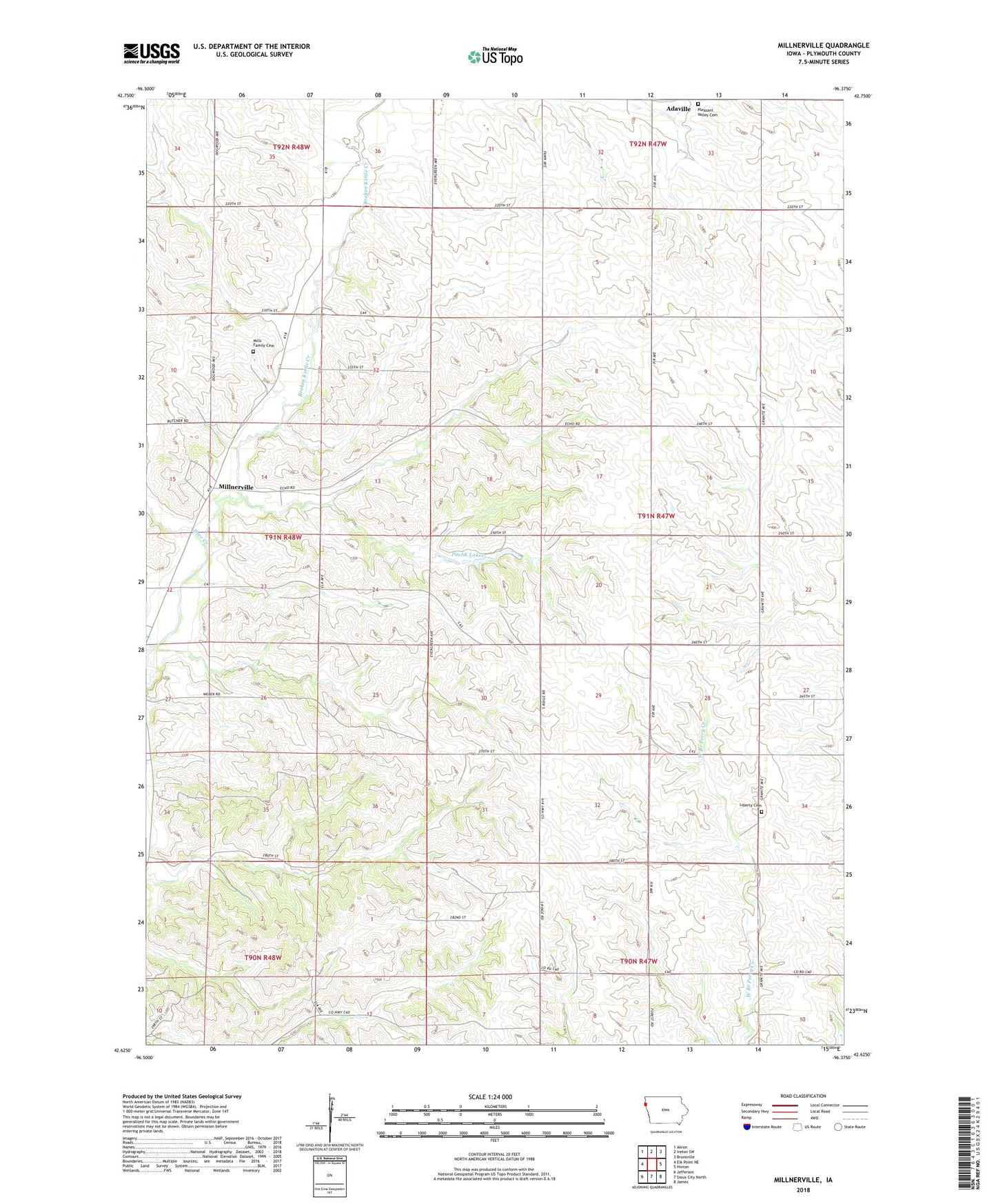
2022 topographic map quadrangle Millnerville in the state of Iowa. Scale: 1:24000. Based on the newly updated USGS 7.5' US Topo map series, this map is in the following counties: Plymouth. The map contains contour data, water features, and other items you are used to seeing on USGS maps, but also has updated roads and other features. This is the next generation of topographic maps. Printed on high-quality waterproof paper with UV fade-resistant inks.
Quads adjacent to this one:
West: Elk Point NE
Northwest: Akron
North: Ireton SW
Northeast: Brunsville
East: Hinton
Southeast: James
South: Sioux City North
Southwest: Jefferson
This map covers the same area as the classic USGS quad with code o42096f4.
Contains the following named places: Adaville United Methodist Church, Deer Creek, Furay, Liberty Perry Cemetery, Millnerville, Millnerville Post Office, Mills Family Cemetery, Pavlik Lakes, Pleasant Valley Cemetery, Sunnyside School, Township of Liberty