MyTopo
Alvord Iowa US Topo Map
Couldn't load pickup availability
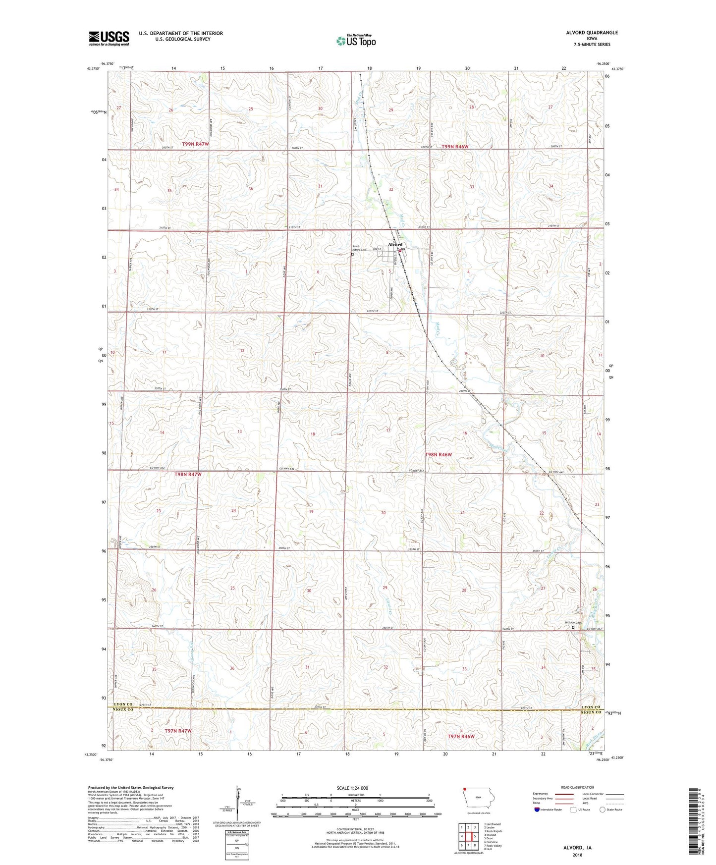
2022 topographic map quadrangle Alvord in the state of Iowa. Scale: 1:24000. Based on the newly updated USGS 7.5' US Topo map series, this map is in the following counties: Lyon, Sioux. The map contains contour data, water features, and other items you are used to seeing on USGS maps, but also has updated roads and other features. This is the next generation of topographic maps. Printed on high-quality waterproof paper with UV fade-resistant inks.
Quads adjacent to this one:
West: Inwood
Northwest: Larchwood
North: Lester
Northeast: Rock Rapids
East: Doon
Southeast: Hull
South: Rock Valley
Southwest: Fairview
This map covers the same area as the classic USGS quad with code o43096c3.
Contains the following named places: Altena Farms, Alvord, Alvord Feed and Supply Incorporated Elevator, Alvord Fire Department, Alvord Post Office, Christ Lutheran Church, City of Alvord, Eagle Avenue Farm, Farmers Elevator Company Elevator, Helgerson Post Office, Hillside Cemetery, Kelly Stock Farms, L and M Farm, Lizard Creek, M D F Farms, Mogler Farms, Pine Groves Farm, Sacred Heart Catholic Church, Saint Marys Cemetery, Serck Farms, Teunissen Farms, Township of Doon, Triple T Farms, Winding Meadows Dairy, Y - Do - I Farm, ZIP Code: 51230