MyTopo
Rock Rapids Iowa US Topo Map
Couldn't load pickup availability
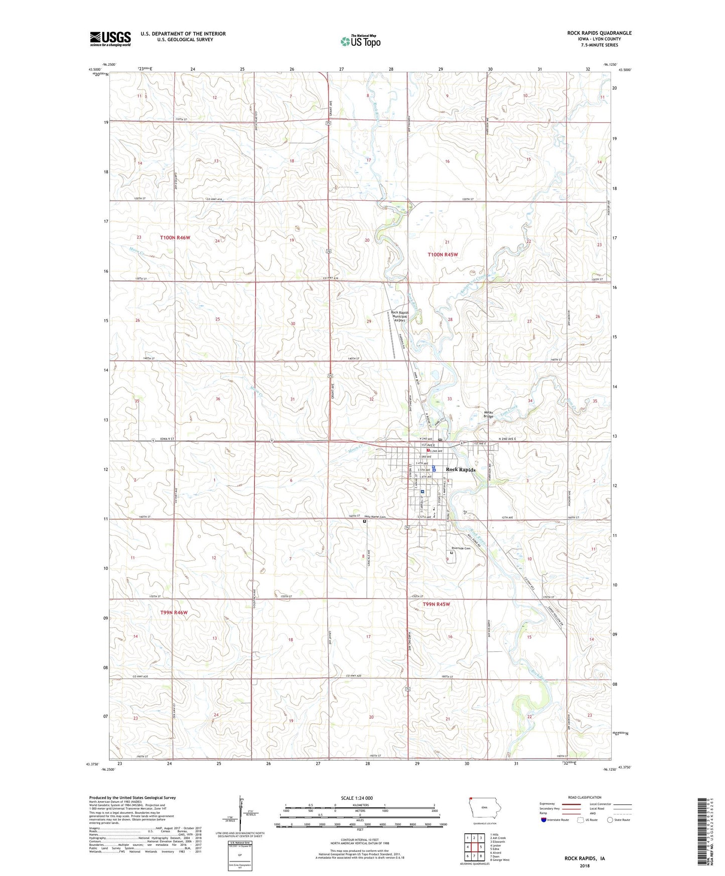
2022 topographic map quadrangle Rock Rapids in the state of Iowa. Scale: 1:24000. Based on the newly updated USGS 7.5' US Topo map series, this map is in the following counties: Lyon. The map contains contour data, water features, and other items you are used to seeing on USGS maps, but also has updated roads and other features. This is the next generation of topographic maps. Printed on high-quality waterproof paper with UV fade-resistant inks.
Quads adjacent to this one:
West: Lester
Northwest: Hills
North: Ash Creek
Northeast: Ellsworth
East: Edna
Southeast: George West
South: Doon
Southwest: Alvord
This map covers the same area as the classic USGS quad with code o43096d2.
Contains the following named places: C S Farms, Central Lyon Elementary School, Central Lyon High School, Central Lyon Middle School, Christian Church, Christian Reformed Church, Christian School, City of Rock Rapids, Congregational United Church, Emma Sater Park, Faith Baptist Church, Farmers Cooperative Exchange Elevator, First Reformed Church, Herbert Farm, Hoff Farms, Holy Name Catholic Church, Holy Name Cemetery, Immanuel Lutheran Church, Island Park, Island Park Campground, Jones Chiropractic Clinic, Kanaranzi Creek, Kiwanis Park, Ladd Farms, Lyon County, Lyon County Ambulance, Lyon County Courthouse, Lyon County Fairgrounds, Lyon County Historical Society Museum Complex, Lyon County Sheriff's Office, Lyon Manor Care Center, Melan Bridge, Merrill Pioneer Community Hospital Heliport, Moon Creek, Peace Lutheran Church, Pioneer Medical Center, Rapids Chiropractic Clinic, Riverview Cemetery, Rock Rapids, Rock Rapids Country Club, Rock Rapids Fire Department, Rock Rapids Municipal Airport, Rock Rapids Police Department, Rock Rapids Post Office, Rock Rapids Public Library, Rock Rapids Trail, Rozeboom Farm, Sanford Rock Rapids Medical Center, Site of First White Mans Home in Lyon County Historical Marker, Tom Creek, Township of Riverside, Township of Rock, United Methodist Church, Westside Park, Westside Park Campground, ZIP Code: 51246