
MyTopo
Doon Iowa US Topo Map
Couldn't load pickup availability
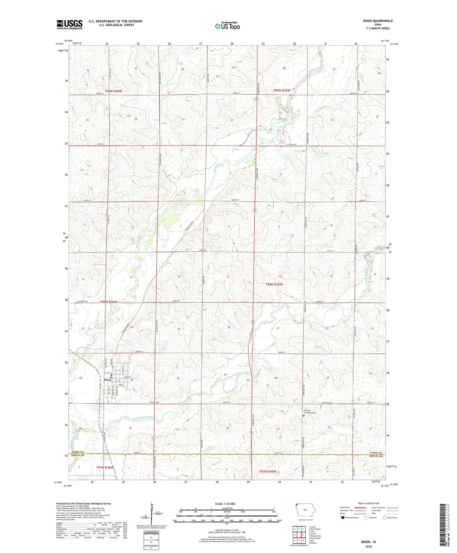
2022 topographic map quadrangle Doon in the state of Iowa. Scale: 1:24000. Based on the newly updated USGS 7.5' US Topo map series, this map is in the following counties: Lyon, Sioux. The map contains contour data, water features, and other items you are used to seeing on USGS maps, but also has updated roads and other features. This is the next generation of topographic maps. Printed on high-quality waterproof paper with UV fade-resistant inks.
Quads adjacent to this one:
West: Alvord
Northwest: Lester
North: Rock Rapids
Northeast: Edna
East: George West
Southeast: Boyden
South: Hull
Southwest: Rock Valley
This map covers the same area as the classic USGS quad with code o43096c2.
Contains the following named places: Anderson Feeds Incorporated Elevator, Brinkhous Farms, City of Doon, De Boer Farm, Deere Lane Farms, Dengler Farms, Doon, Doon Christian School, Doon Elevator Company Elevator, Doon Fire Department, Doon Post Office, Doon Protestant Reformed Church, Doon Wildlife Area, Dusty Hollow Farms, Farmers Elevator Company Elevator, First Congregational Church, First Reformed Church, G and B Farm, Garfield Township Cemetery, Hasche Farms, Lakewood, Lakewood Corner, Lakewood Corners Wildlife Area, Lakewood Farm, Lakewood Post Office, Little Rock River, Maassen Farm, Mud Creek, Northwest Iowa Protestant Reformed School, Post Farm, Smead Post Office, Sunny View Farm, Township of Garfield, United Reformed Church, Vandevegte Farm, Vanoort Farm, Wynia Farms, ZIP Code: 51235


