MyTopo
Baldwin Iowa US Topo Map
Couldn't load pickup availability
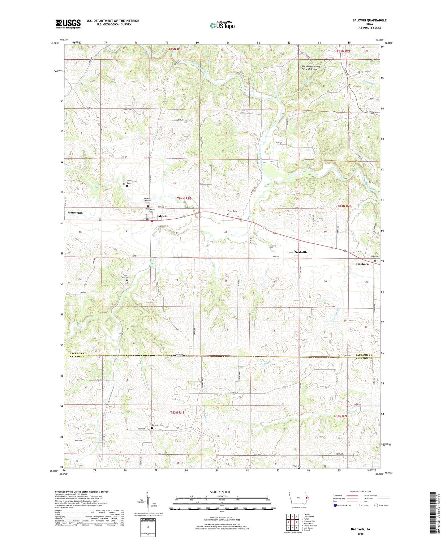
2022 topographic map quadrangle Baldwin in the state of Iowa. Scale: 1:24000. Based on the newly updated USGS 7.5' US Topo map series, this map is in the following counties: Jackson, Clinton. The map contains contour data, water features, and other items you are used to seeing on USGS maps, but also has updated roads and other features. This is the next generation of topographic maps. Printed on high-quality waterproof paper with UV fade-resistant inks.
Quads adjacent to this one:
West: Wyoming East
Northwest: Canton
North: Leisure Lake
Northeast: Fulton
East: Maquoketa
Southeast: Elwood
South: Lost Nation
Southwest: Oxford Junction
This map covers the same area as the classic USGS quad with code o42090a7.
Contains the following named places: Baldwin, Baldwin Monmouth Methodist Church, Baldwin Post Office, Baldwin Volunteer Fire Department, Bear Creek, Beers Creek, Buckhorn, Buckhorn Waterford Cemetery, Burgess, Burgess Post Office, City of Baldwin, Eden Valley County Refuge, Eden Valley Nature Centure, Foley Farm Cemetery, Hershberger Cemetery, Holy Trinity Catholic Cemetery, Holy Trinity Church, Joinerville County Park, Lost Nation Public Hunting Area, Maquoketa Caves Natural Bridge, Maquoketa Caves State Park, Mill Rock School County Park, Millrock, Nashville, Nashville Post Office, Pence Cemetery, Raccoon Creek, Rat Run, Reel Cemetery, Township of Monmouth, Washington Cemetery, Waterford Post Office, ZIP Code: 52207