MyTopo
Fulton Iowa US Topo Map
Couldn't load pickup availability
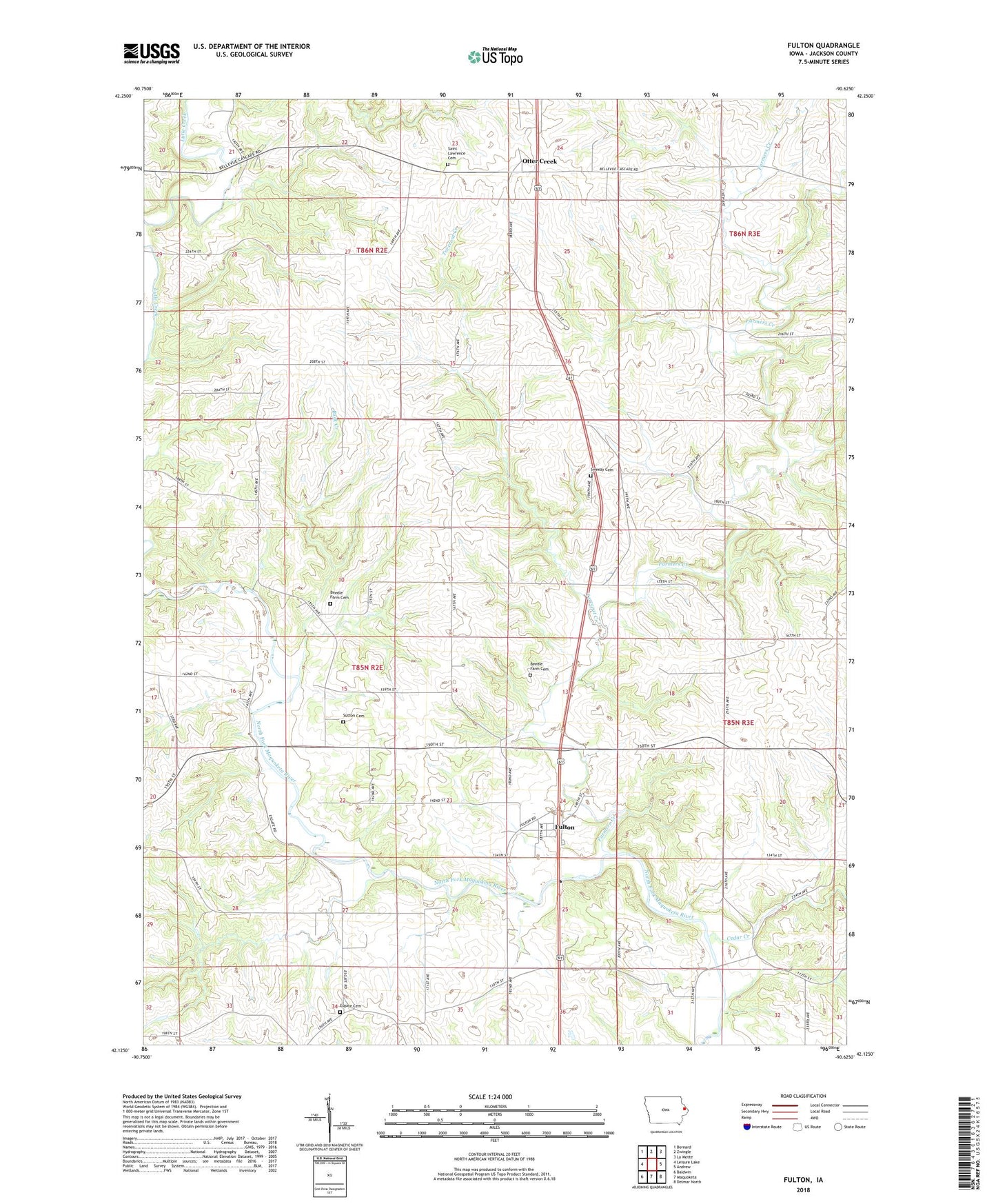
2022 topographic map quadrangle Fulton in the state of Iowa. Scale: 1:24000. Based on the newly updated USGS 7.5' US Topo map series, this map is in the following counties: Jackson. The map contains contour data, water features, and other items you are used to seeing on USGS maps, but also has updated roads and other features. This is the next generation of topographic maps. Printed on high-quality waterproof paper with UV fade-resistant inks.
Quads adjacent to this one:
West: Leisure Lake
Northwest: Bernard
North: Zwingle
Northeast: La Motte
East: Andrew
Southeast: Delmar North
South: Maquoketa
Southwest: Baldwin
This map covers the same area as the classic USGS quad with code o42090b6.
Contains the following named places: Beedle Farm Cemetery, Buck Creek, Cedar Creek, East Iron Hills, Esgate Cemetery, Farmers Creek, Fulton, Fulton Post Office, Iron Hill Quarry, New Castle Post Office, Otter Creek, Ottercreek Post Office, Saint Lawrence Cemetery, Saint Lawrence Church, Sutton Cemetery, Sweezy Cemetery, Tarecoat Creek, Township of Farmers Creek