MyTopo
Leisure Lake Iowa US Topo Map
Couldn't load pickup availability
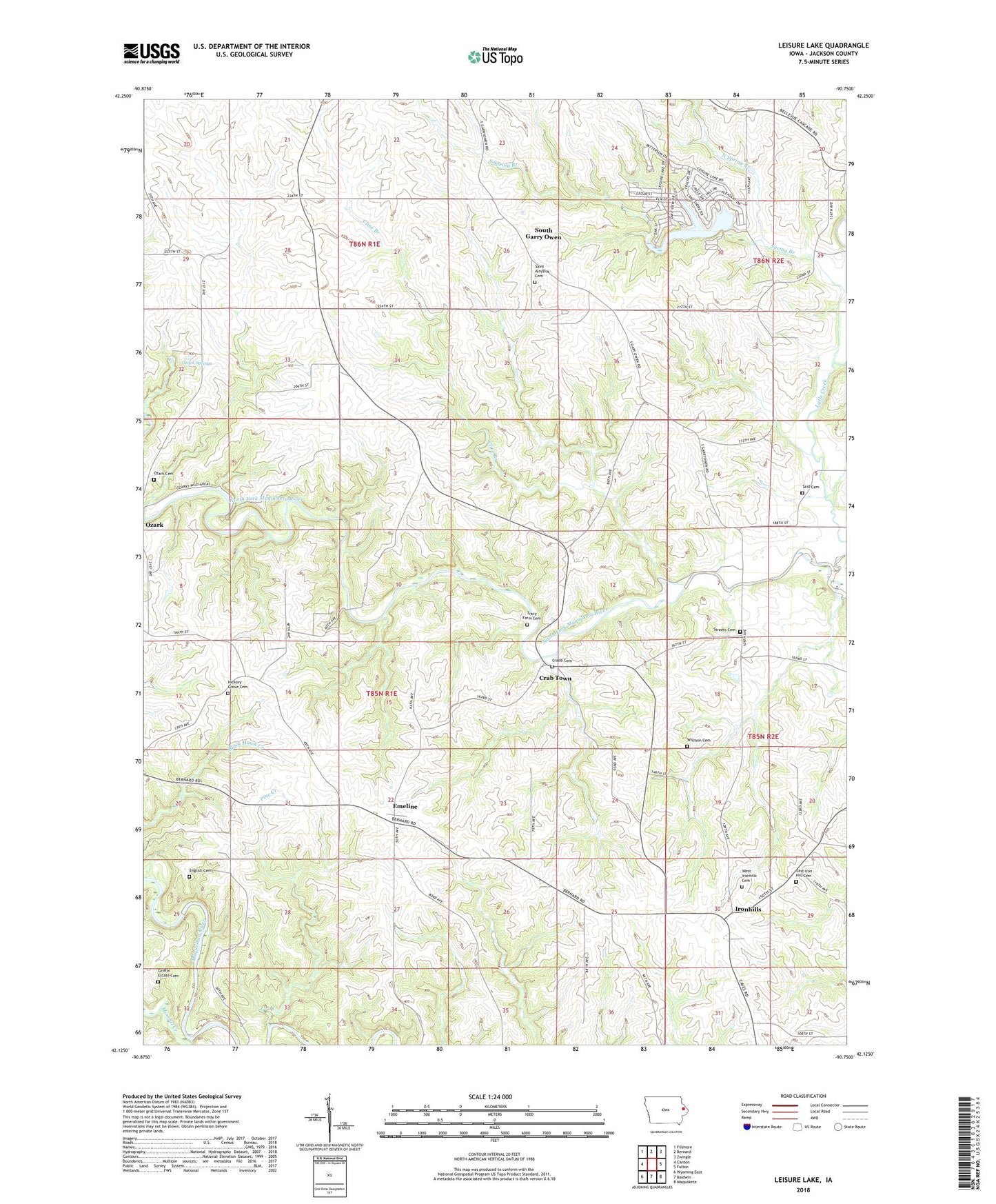
2022 topographic map quadrangle Leisure Lake in the state of Iowa. Scale: 1:24000. Based on the newly updated USGS 7.5' US Topo map series, this map is in the following counties: Jackson. The map contains contour data, water features, and other items you are used to seeing on USGS maps, but also has updated roads and other features. This is the next generation of topographic maps. Printed on high-quality waterproof paper with UV fade-resistant inks.
Quads adjacent to this one:
West: Canton
Northwest: Fillmore
North: Bernard
Northeast: Zwingle
East: Fulton
Southeast: Maquoketa
South: Baldwin
Southwest: Wyoming East
This map covers the same area as the classic USGS quad with code o42090b7.
Contains the following named places: Alma Post Office, Buzzard Ridge Wildlife Area, Cline Branch, Crab Town, Crabb Cemetery, Crabb Post Office, Crabb's Mills Post Office, Duggan Post Office, East Iron Hill Cemetery, East Ironhills Church, Emeline, Emeline Post Office, English Cemetery, Griffin Estate Cemetery, Hickory Grove Cemetery, Iron Hills Post Office, Ironhills, Leisure Lake, Lytle Creek, Mineral Creek, North Spring Branch, Ozark, Ozark Cemetery, Ozark Post Office, Ozark Springs, Ozark Wildlife Area, Pine Creek, Said Cemetery, Saint Aloysius Cemetery, Saint Aloysius Church, Schwenker Lake Dam, South Garry Owen, South Spring Branch, Spring Branch, Streets Cemetery, Township of Brandon, Tracy Farm Cemetery, West Iron Hills, West Ironhills Cemetery, William Potter Historical Marker, Willison Cemetery