MyTopo
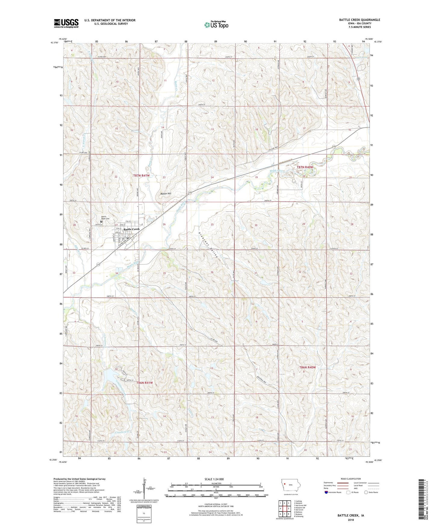
Battle Creek Iowa US Topo Map
Couldn't load pickup availability
2022 topographic map quadrangle Battle Creek in the state of Iowa. Scale: 1:24000. Based on the newly updated USGS 7.5' US Topo map series, this map is in the following counties: Ida. The map contains contour data, water features, and other items you are used to seeing on USGS maps, but also has updated roads and other features. This is the next generation of topographic maps. Printed on high-quality waterproof paper with UV fade-resistant inks.
Quads adjacent to this one:
West: Holstein SW
Northwest: Cushing
North: Holstein
Northeast: Ida Grove NW
East: Ida Grove
Southeast: Schleswig
South: Ricketts
Southwest: Danbury
This map covers the same area as the classic USGS quad with code o42095c5.
Contains the following named places: Aldrich Creek, Battle Creek, Battle Creek - Ida Grove Intermediate School, Battle Creek City Fire Department, Battle Creek City Hall, Battle Creek City Police, Battle Creek Community Ambulance Service, Battle Creek Elementary School, Battle Creek Post Office, Battle Creek Public Library, Battle Hill, Battle Hill Museum of Natural History, City of Battle Creek, Crawford Creek, Crawford Creek County Recreation Area, Evergreen Lawn Farm, Final Four Farm, Grell Pond, Grell Pond Dam, Hieber Park, Hofmann Farms, Ida County Fairgrounds, J and K Farms, J B W Farms, Lund Creek, Maple Number Five School, Moorehead School, Mount Hope Cemetery, Pale Willow Care Center, Pleasant Valley, Presbyterian Church, Rabe Farms, Saint Johns Lutheran Church, Schoen Farms, Township of Garfield, Township of Maple, Uhl Farms, Van Houten Farms, ZIP Code: 51006