MyTopo
Holstein Iowa US Topo Map
Couldn't load pickup availability
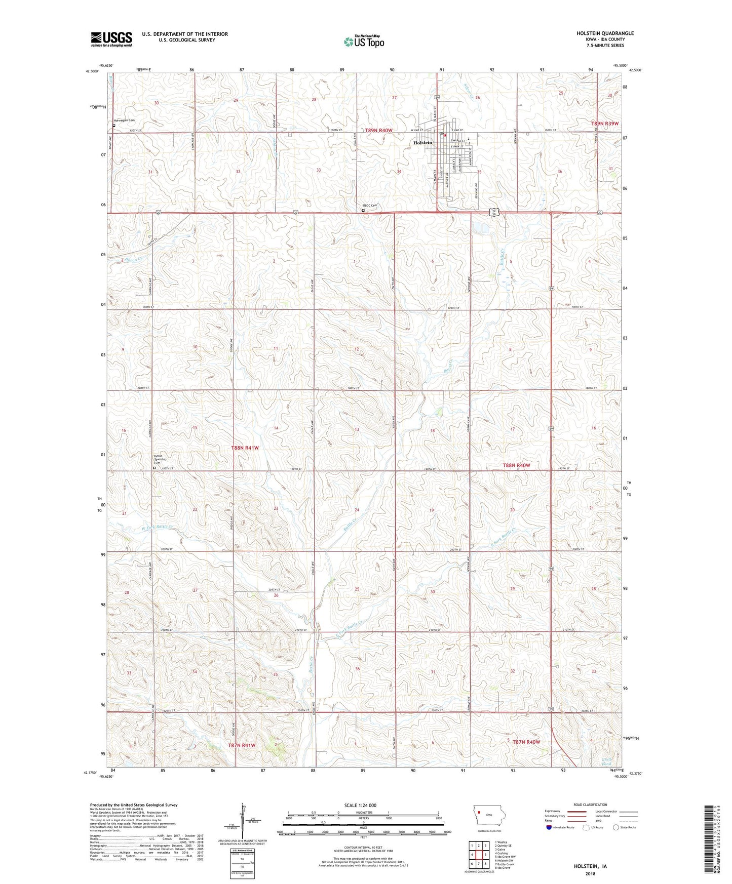
2022 topographic map quadrangle Holstein in the state of Iowa. Scale: 1:24000. Based on the newly updated USGS 7.5' US Topo map series, this map is in the following counties: Ida. The map contains contour data, water features, and other items you are used to seeing on USGS maps, but also has updated roads and other features. This is the next generation of topographic maps. Printed on high-quality waterproof paper with UV fade-resistant inks.
Quads adjacent to this one:
West: Cushing
Northwest: Washta
North: Quimby SE
Northeast: Galva
East: Ida Grove NW
Southeast: Ida Grove
South: Battle Creek
Southwest: Holstein SW
This map covers the same area as the classic USGS quad with code o42095d5.
Contains the following named places: Battle Center Cemetery, Battle Center Church, City of Holstein, Cornelia Post Office, East Fork Battle Creek, Holstein, Holstein City Library, Holstein Cooperative Elevator, Holstein Country Club, Holstein Elementary School, Holstein Family and Sports Chiropractic Center, Holstein Family Practice Associates Building, Holstein Fire Department and Ambulance, Holstein Post Office, Ida County, Johnsons Farm, Lohff Schuman Memorial Center, Luscombe Farms, Norwegian Cemetery, Our Lady of Good Counsel Cemetery, Our Lady of Good Counsel Church, Ridge View High School, Saint Pauls Lutheran Church, Schmidt Farms, Sioux Valley Medical Associates Center, Thankful Harvest Farm, Township of Battle, United Methodist Church, Veterans Memorial Hall, West Fork Battle Creek, Willow Dale Post Office, Wittrock Farms, ZIP Code: 51025