MyTopo
Holstein SW Iowa US Topo Map
Couldn't load pickup availability
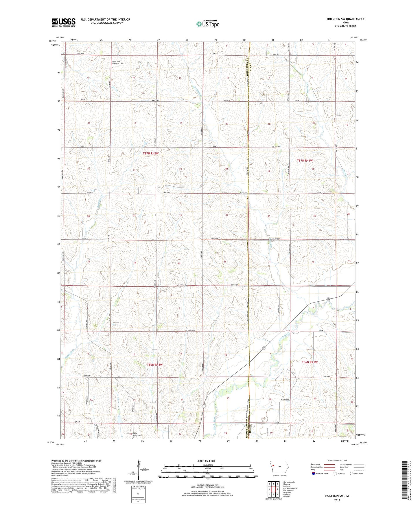
2022 topographic map quadrangle Holstein SW in the state of Iowa. Scale: 1:24000. Based on the newly updated USGS 7.5' US Topo map series, this map is in the following counties: Woodbury, Ida. The map contains contour data, water features, and other items you are used to seeing on USGS maps, but also has updated roads and other features. This is the next generation of topographic maps. Printed on high-quality waterproof paper with UV fade-resistant inks.
Quads adjacent to this one:
West: Correctionville SE
Northwest: Correctionville
North: Cushing
Northeast: Holstein
East: Battle Creek
Southeast: Ricketts
South: Danbury
Southwest: Mapleton
This map covers the same area as the classic USGS quad with code o42095c6.
Contains the following named places: Bar Farms, East Aldrich Creek, Midway, Midway Post Office, Moorhead Creek, Morris, Morris Post Office, Saint Paul Lutheran Cemetery, Saint Pauls Church, Township of Liston, Township of Morgan, ZIP Code: 51019