MyTopo
Beech Iowa US Topo Map
Couldn't load pickup availability
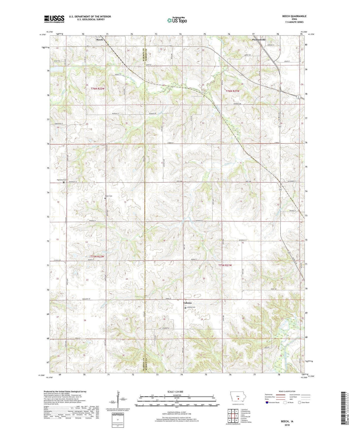
2022 topographic map quadrangle Beech in the state of Iowa. Scale: 1:24000. Based on the newly updated USGS 7.5' US Topo map series, this map is in the following counties: Marion, Warren. The map contains contour data, water features, and other items you are used to seeing on USGS maps, but also has updated roads and other features. This is the next generation of topographic maps. Printed on high-quality waterproof paper with UV fade-resistant inks.
Quads adjacent to this one:
West: Milo
Northwest: Hartford
North: Pleasantville
Northeast: Knoxville NW
East: Knoxville SW
Southeast: Melcher-Dallas
South: Newbern
Southwest: Lacona
This map covers the same area as the classic USGS quad with code o41093c3.
Contains the following named places: Beech, Beech Community Park, Beech Post Office, Caloma, Caloma Post Office, Coloma Cemetery, Coon Creek, Crow Creek, Fair View Church, Felix Post Office, Fly Creek, Highland Cemetery, Motor Cemetery, Motor Church, Motor Post Office, Star Post Office, Township of Franklin, Township of Union