MyTopo
Knoxville NW Iowa US Topo Map
Couldn't load pickup availability
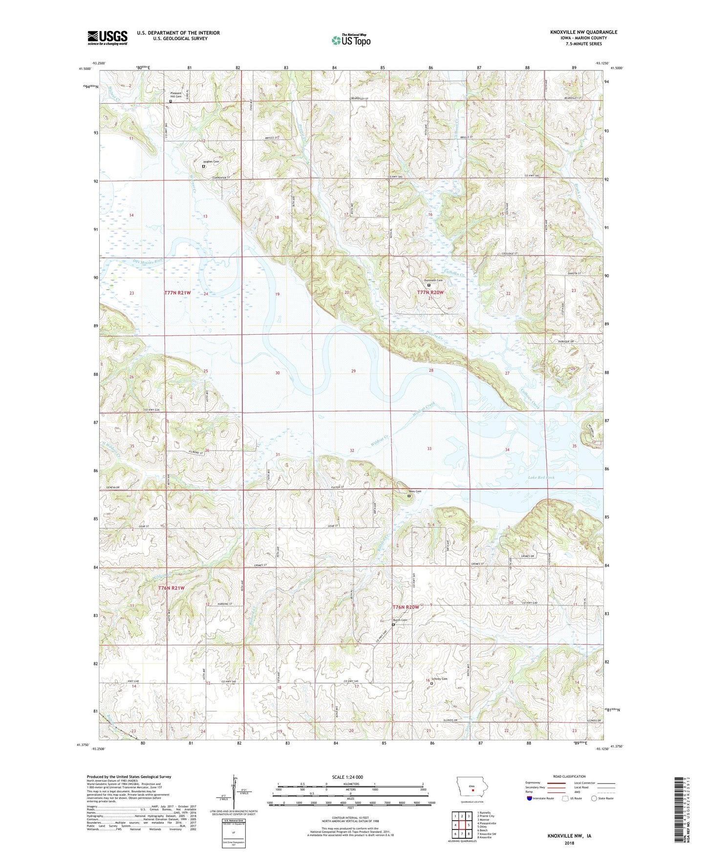
2022 topographic map quadrangle Knoxville NW in the state of Iowa. Scale: 1:24000. Based on the newly updated USGS 7.5' US Topo map series, this map is in the following counties: Marion. The map contains contour data, water features, and other items you are used to seeing on USGS maps, but also has updated roads and other features. This is the next generation of topographic maps. Printed on high-quality waterproof paper with UV fade-resistant inks.
Quads adjacent to this one:
West: Pleasantville
Northwest: Runnells
North: Prairie City
Northeast: Monroe
East: Otley
Southeast: Knoxville
South: Knoxville SW
Southwest: Beech
This map covers the same area as the classic USGS quad with code o41093d2.
Contains the following named places: Ballard Creek, Burch Cemetery, Calhoun Creek, Dunreath, Dunreath Cemetery, Dunreath Post Office, Hughes Cemetery, Lucas Grove Post Office, North Wildcat Creek, Oak Post Office, Paran City Post Office, Pickway Post Office, Pleasant Hill Cemetery, Prairie Creek, Rees Cemetery, Schirey Cemetery, Township of Red Rock, Township of Union, Walnut Creek, Wildcat Creek