
MyTopo
Knoxville SW Iowa US Topo Map
Couldn't load pickup availability
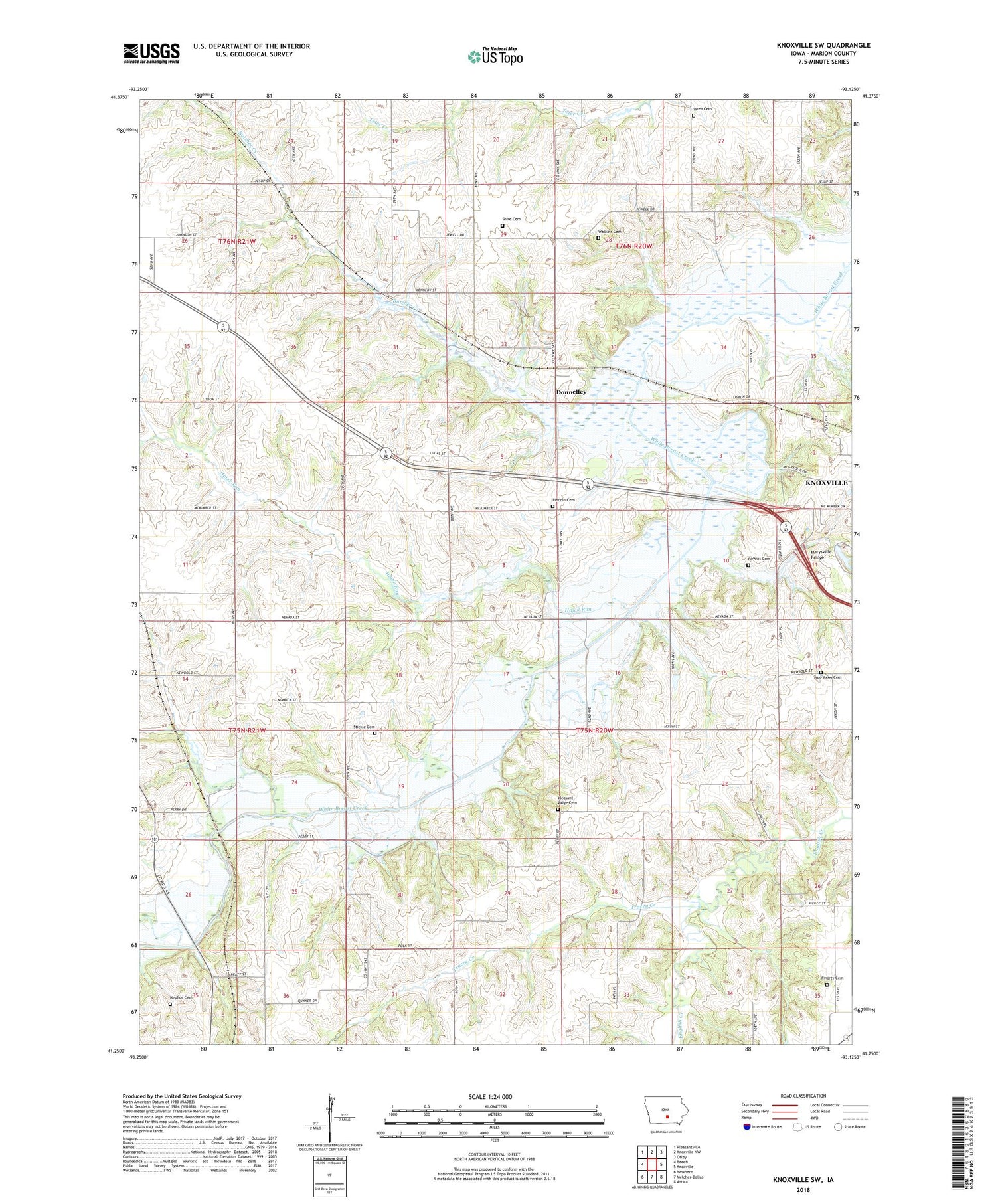
2022 topographic map quadrangle Knoxville SW in the state of Iowa. Scale: 1:24000. Based on the newly updated USGS 7.5' US Topo map series, this map is in the following counties: Marion. The map contains contour data, water features, and other items you are used to seeing on USGS maps, but also has updated roads and other features. This is the next generation of topographic maps. Printed on high-quality waterproof paper with UV fade-resistant inks.
Quads adjacent to this one:
West: Beech
Northwest: Pleasantville
North: Knoxville NW
Northeast: Otley
East: Knoxville
Southeast: Attica
South: Melcher-Dallas
Southwest: Newbern
This map covers the same area as the classic USGS quad with code o41093c2.
Contains the following named places: Butcher Creek, County Care Facility, Donley Post Office, Donley Station, Donnelley, Eden Church, Finarty Cemetery, Hawk Run, Lincoln Cemetery, Marion County Park, Marysville Bridge, Nephus Cemetery, Pleasant Ridge Cemetery, Poor Farm Cemetery, Saint Anthony Cemetery, Shire Cemetery, Stickle Cemetery, Tracey Creek, Watkins Cemetery, Weston Post Office


