MyTopo
Lacona Iowa US Topo Map
Couldn't load pickup availability
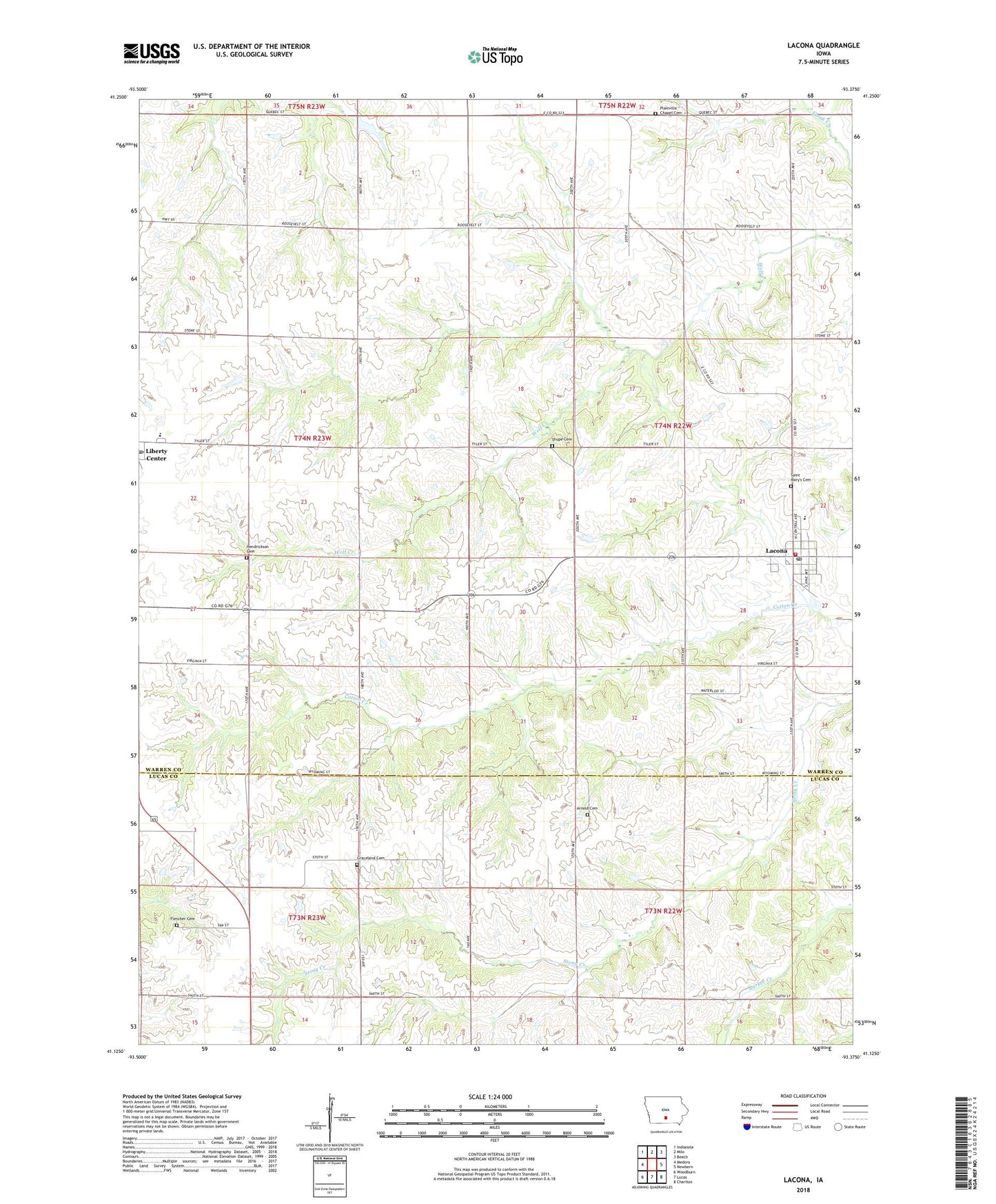
2022 topographic map quadrangle Lacona in the state of Iowa. Scale: 1:24000. Based on the newly updated USGS 7.5' US Topo map series, this map is in the following counties: Warren, Lucas. The map contains contour data, water features, and other items you are used to seeing on USGS maps, but also has updated roads and other features. This is the next generation of topographic maps. Printed on high-quality waterproof paper with UV fade-resistant inks.
Quads adjacent to this one:
West: Medora
Northwest: Indianola
North: Milo
Northeast: Beech
East: Newbern
Southeast: Chariton
South: Lucas
Southwest: Woodburn
This map covers the same area as the classic USGS quad with code o41093b4.
Contains the following named places: Arnold Cemetery, Arnold School, Center School, Church of the Nazarene, City of Lacona, Fletcher Cemetery, Fort Plain, Graceland Cemetery, Green Plain Church, Green Plain School, Hendrickson Cemetery, Lacona, Lacona Bible Baptist Church, Lacona Christian Church, Lacona Community Hall, Lacona Fire and Rescue, Lacona Post Office, Lacona Public Library, Liberty Center, Liberty Center Post Office, Liberty Center United Methodist Church, Mount Olive School, Mumford School, North Liberty School, Norwood Church, Plainville Chapel Cemetery, Primrose School, Saint Marys Catholic Church, Saint Marys of Lacona Cemetery, Saint Paul Lutheran Church, Shupe Cemetery, Southeast Warren Intermediate Center, Southeast Warren Junior - Senior High School, Township of Liberty, Township of White Breast, Union School, United Methodist Church, Willis Log Cabin