MyTopo
Berkley Iowa US Topo Map
Couldn't load pickup availability
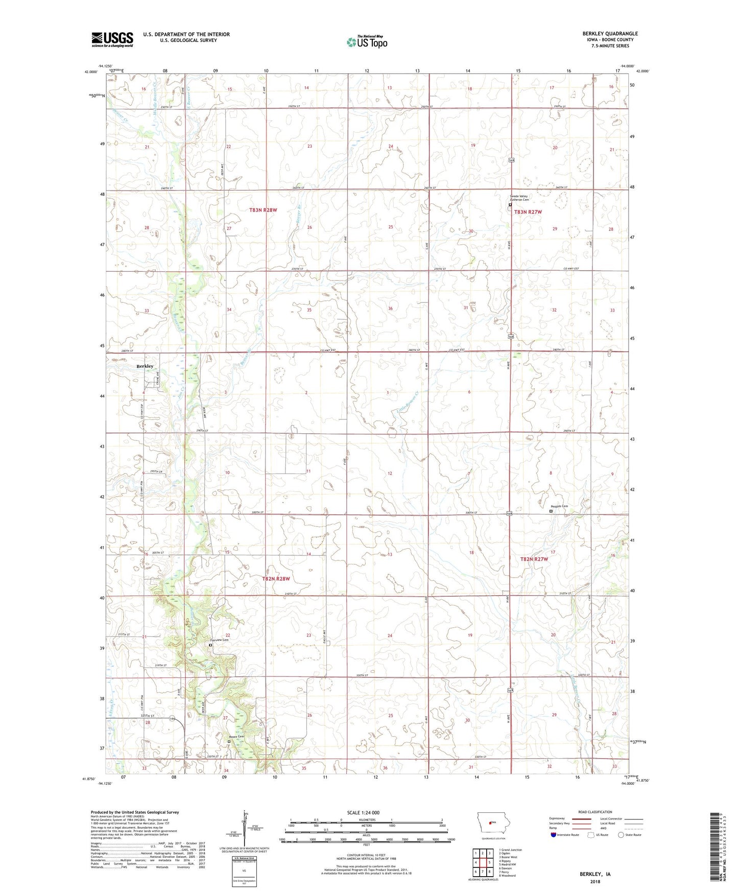
2022 topographic map quadrangle Berkley in the state of Iowa. Scale: 1:24000. Based on the newly updated USGS 7.5' US Topo map series, this map is in the following counties: Boone. The map contains contour data, water features, and other items you are used to seeing on USGS maps, but also has updated roads and other features. This is the next generation of topographic maps. Printed on high-quality waterproof paper with UV fade-resistant inks.
Quads adjacent to this one:
West: Rippey
Northwest: Grand Junction
North: Ogden
Northeast: Boone West
East: Madrid NW
Southeast: Woodward
South: Perry
Southwest: Dawson
This map covers the same area as the classic USGS quad with code o41094h1.
Contains the following named places: Beaver Branch, Berkley, Berkley Post Office, Berkley School, Center School, City of Berkley, David Peoples Cemetery, Douglas School, East Beaver Creek, Fairview Cemetery, Fairview Church, Fredericksen School, Jim Creek, Junction School, Knight Field, Lincoln School, Middle Beaver Creek, Moore Cemetery, Perry Country Club, Swede Valley Church, Swede Valley Lutheran Cemetery, Township of Beaver, Township of Union