MyTopo
Woodward Iowa US Topo Map
Couldn't load pickup availability
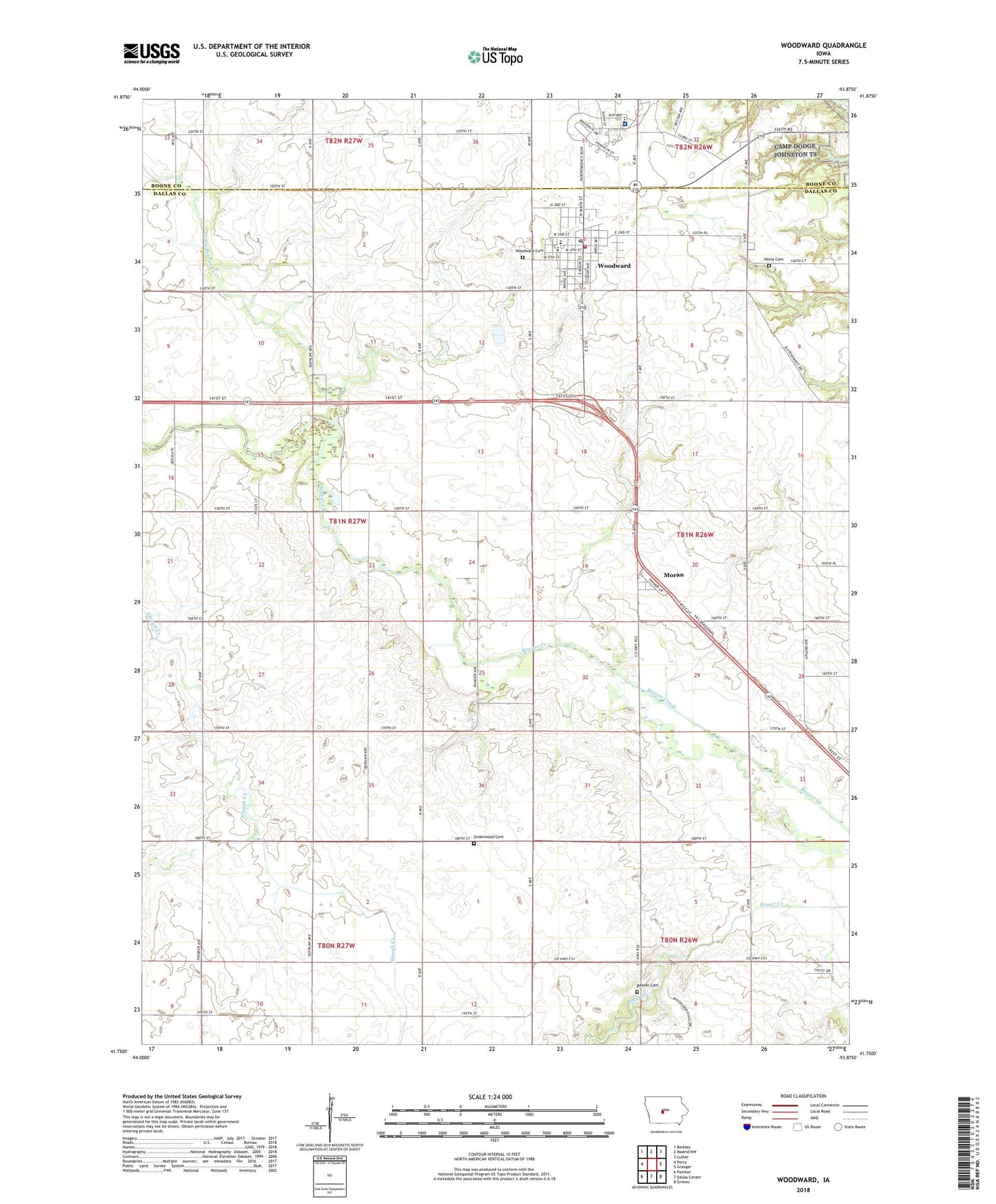
2022 topographic map quadrangle Woodward in the state of Iowa. Scale: 1:24000. Based on the newly updated USGS 7.5' US Topo map series, this map is in the following counties: Dallas, Boone. The map contains contour data, water features, and other items you are used to seeing on USGS maps, but also has updated roads and other features. This is the next generation of topographic maps. Printed on high-quality waterproof paper with UV fade-resistant inks.
Quads adjacent to this one:
West: Perry
Northwest: Berkley
North: Madrid NW
Northeast: Luther
East: Granger
Southeast: Grimes
South: Dallas Center
Southwest: Panther
This map covers the same area as the classic USGS quad with code o41093g8.
Contains the following named places: Assembly of God Church, Beaver Cemetery, Beulah School, Branett School, Christian Church, City of Woodward, East Beaver School, Greenwood Cemetery, Lake Robbins Ballroom, Little Beaver Creek, Moran, Moran Post Office, School Number 3, Township of Beaver, United Methodist Church, West Beaver School, Woodward, Woodward - Granger Grandwood Special Education Center, Woodward - Granger High School, Woodward - Granger Middle School, Woodward Academy, Woodward Cemetery, Woodward City Hall, Woodward Golf and Recreation, Woodward Post Office, Woodward Public Library, Woodward State Hospital, Woodward State Hospital Heliport, Woodward USA Health Care Center, Woodward Volunteer Fire Department, Xenia, Xenia Cemetery, ZIP Codes: 50039, 50276