MyTopo
Blakesburg NE Iowa US Topo Map
Couldn't load pickup availability
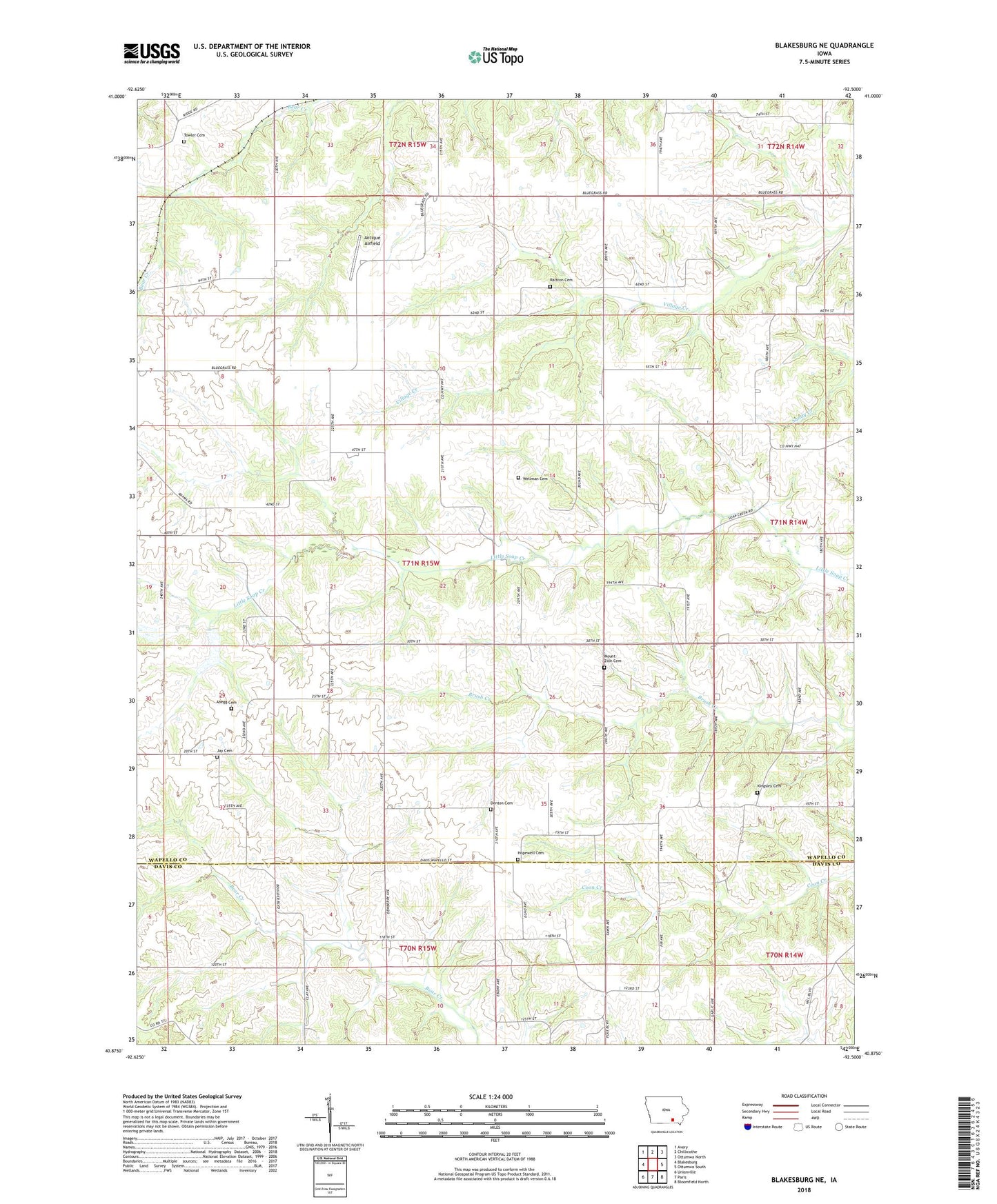
2022 topographic map quadrangle Blakesburg NE in the state of Iowa. Scale: 1:24000. Based on the newly updated USGS 7.5' US Topo map series, this map is in the following counties: Wapello, Davis. The map contains contour data, water features, and other items you are used to seeing on USGS maps, but also has updated roads and other features. This is the next generation of topographic maps. Printed on high-quality waterproof paper with UV fade-resistant inks.
Quads adjacent to this one:
West: Blakesburg
Northwest: Avery
North: Chillicothe
Northeast: Ottumwa North
East: Ottumwa South
Southeast: Bloomfield North
South: Paris
Southwest: Unionville
This map covers the same area as the classic USGS quad with code o40092h5.
Contains the following named places: Abegg Cemetery, Antique Airfield, Cooperville Post Office, Denton Cemetery, Hopewell Cemetery, Hopewell Church, Jay Cemetery, Kingsley Cemetery, Mount Zion Cemetery, Mount Zion Church, Pleasant Home Church, Ralston Cemetery, Towler Cemetery, Township of Adams, Wellman Cemetery, ZIP Code: 52536