MyTopo
Chillicothe Iowa US Topo Map
Couldn't load pickup availability
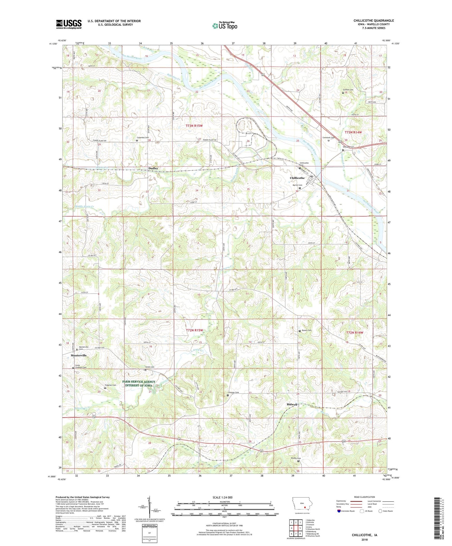
2022 topographic map quadrangle Chillicothe in the state of Iowa. Scale: 1:24000. Based on the newly updated USGS 7.5' US Topo map series, this map is in the following counties: Wapello. The map contains contour data, water features, and other items you are used to seeing on USGS maps, but also has updated roads and other features. This is the next generation of topographic maps. Printed on high-quality waterproof paper with UV fade-resistant inks.
Quads adjacent to this one:
West: Avery
Northwest: Eddyville
North: Kirkville
Northeast: Fremont
East: Ottumwa North
Southeast: Ottumwa South
South: Blakesburg NE
Southwest: Blakesburg
This map covers the same area as the classic USGS quad with code o41092a5.
Contains the following named places: Bidwell, Bidwell Post Office, Bowen Cemetery, Brooks Cemetery, Brown Creek, Chillicothe, Chillicothe Cemetery, Chillicothe First Responders, Chillicothe Post Office, Chisman Cemetery, Christianburg Church, Christiansburgh Post Office, City of Chillicothe, Columbia Cemetery, Columbia Church, Comstock Cemetery, Comstock Creek, Comstock Post Office, Comstock Station, Dudley, Dudley Post Office, Folgman Cemetery, Fountain Springs Post Office, Fudge Creek, Griffith Cemetery, Happy Hollow, Happy Hollow Post Office, Kirkville Station, Little Chisman Cemetery, McNeese Wildlife Area, Middle Avery Creek, Munterville, Munterville Cemetery, Munterville Lutheran Church, Munterville Post Office, Myrick Cemetery, North Avery Creek, Palestine Creek, Sand Stone, Shocks Post Office, Shocks Station, Smith Cemetery, South Avery Creek, Township of Cass, Township of Columbia, Township of Polk, West Gate Rest Area, Willard, Willard Post Office, Williams Cemetery, ZIP Code: 52548