MyTopo
Avery Iowa US Topo Map
Couldn't load pickup availability
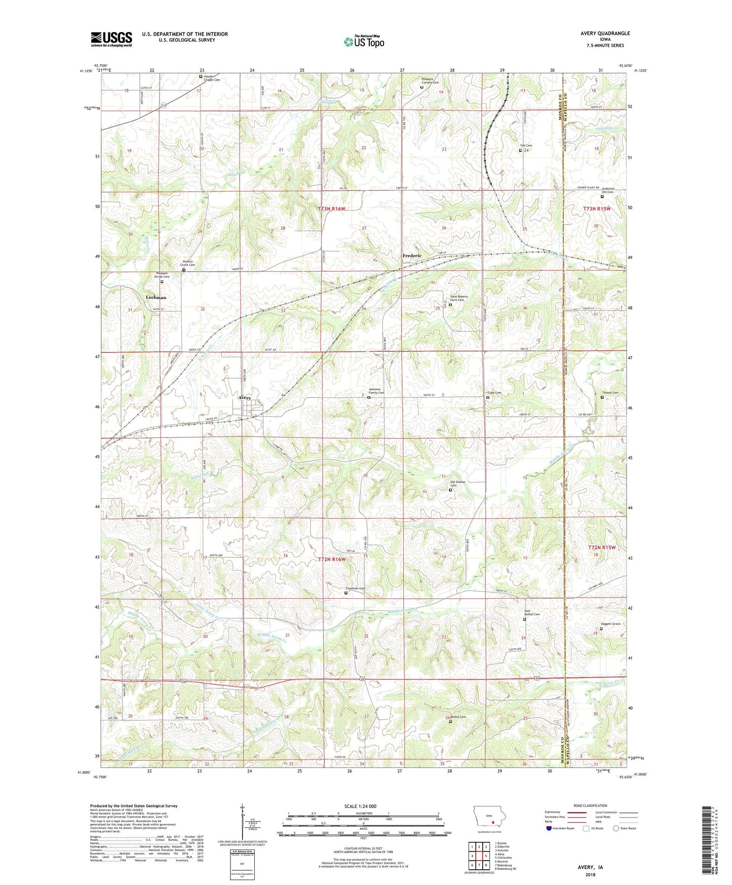
2022 topographic map quadrangle Avery in the state of Iowa. Scale: 1:24000. Based on the newly updated USGS 7.5' US Topo map series, this map is in the following counties: Monroe, Wapello. The map contains contour data, water features, and other items you are used to seeing on USGS maps, but also has updated roads and other features. This is the next generation of topographic maps. Printed on high-quality waterproof paper with UV fade-resistant inks.
Quads adjacent to this one:
West: Albia
Northwest: Buxton
North: Eddyville
Northeast: Kirkville
East: Chillicothe
Southeast: Blakesburg NE
South: Blakesburg
Southwest: Moravia
This map covers the same area as the classic USGS quad with code o41092a6.
Contains the following named places: Anderson Hill Cemetery, Avery, Avery Post Office, Bethel Cemetery, Chedister Cemetery, Chisholm Post Office, Coalfield, Coalfield Post Office, Cuba Cemetery, Cuba Post Office, Daggett Grave, Dave Roberts Farm Cemetery, East Bethel Cemetery, Fall Cemetery, Frederic, Fredric, Fredric Post Office, Halfway Prairie Post Office, Hayden Chapel, Hayden Chapel Cemetery, Hickory Grove Cemetery, Hynes Post Office, Johnston Family Cemetery, KLBA-AM (Albia), Little Avery Creek, Lockman, Lockman Post Office, Old Shahan Cemetery, Packinghouse Creek, Pleasant Corner, Pleasant Corners Cemetery, Pleasant Corners Church, Pleasant Divide Cemetery, Thorpe Cemetery, Township of Mantua, Township of Pleasant, White Ash Branch