MyTopo
Boxholm Iowa US Topo Map
Couldn't load pickup availability
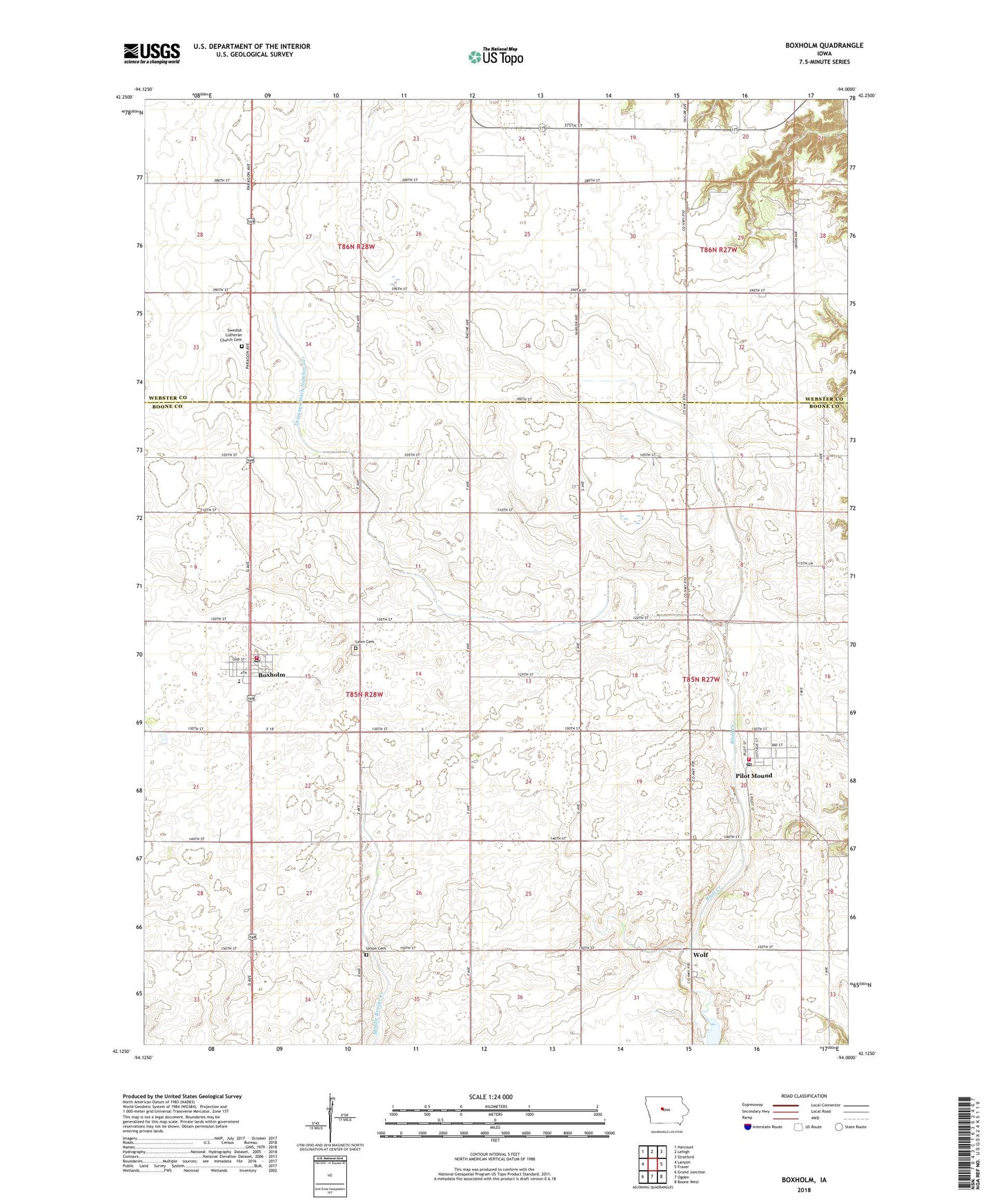
2022 topographic map quadrangle Boxholm in the state of Iowa. Scale: 1:24000. Based on the newly updated USGS 7.5' US Topo map series, this map is in the following counties: Boone, Webster. The map contains contour data, water features, and other items you are used to seeing on USGS maps, but also has updated roads and other features. This is the next generation of topographic maps. Printed on high-quality waterproof paper with UV fade-resistant inks.
Quads adjacent to this one:
West: Lanyon
Northwest: Harcourt
North: Lehigh
Northeast: Stratford
East: Fraser
Southeast: Boone West
South: Ogden
Southwest: Grand Junction
This map covers the same area as the classic USGS quad with code o42094b1.
Contains the following named places: Boxholm, Boxholm Fire Department, Boxholm Post Office, Boxholm Town Hall, Casady Post Office, City of Boxholm, City of Pilot Mound, Don Williams Golf Course, Drainage Ditch Number 107, Lawn Cemetery, Methodist Church, Pilot Mound, Pilot Mound Fire and Rescue Department, Pilot Mound Post Office, Pilot Mound State Forest, Pilotmound, Ritchie School, Southeast Webster - Grand Middle School, Swedish Lutheran Church Cemetery, Township of Grant, Township of Pilot Mound, Trinity Lutheran Church, Union Cemetery, United Methodist Church, Wolf, ZIP Code: 50223