MyTopo
Fraser Iowa US Topo Map
Couldn't load pickup availability
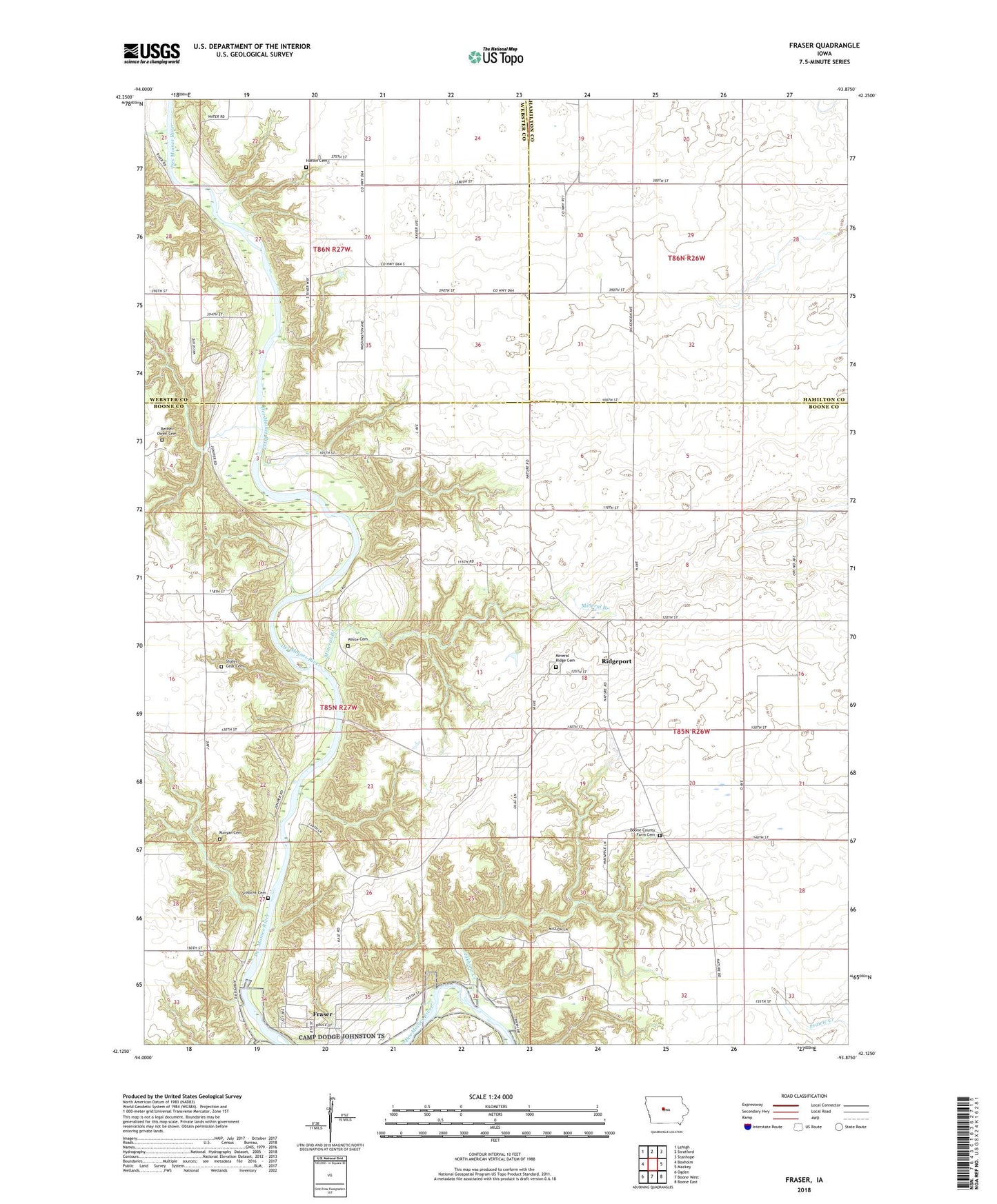
2022 topographic map quadrangle Fraser in the state of Iowa. Scale: 1:24000. Based on the newly updated USGS 7.5' US Topo map series, this map is in the following counties: Boone, Webster, Hamilton. The map contains contour data, water features, and other items you are used to seeing on USGS maps, but also has updated roads and other features. This is the next generation of topographic maps. Printed on high-quality waterproof paper with UV fade-resistant inks.
Quads adjacent to this one:
West: Boxholm
Northwest: Lehigh
North: Stratford
Northeast: Stanhope
East: Mackey
Southeast: Boone East
South: Boone West
Southwest: Ogden
This map covers the same area as the classic USGS quad with code o42093b8.
Contains the following named places: Barkley Memorial State Park, Bethel Owen Cemetery, Boone County Farm Cemetery, Boone County Home, Camp Morrison, Carlson Recreation Area, Carson's Point Post Office, Elkhorn Creek, Fraser, Fraser Post Office, Fraser School, Hardin Township Cemetery, King Feedlot, Mineral Branch, Mineral Ridge, Mineral Ridge Baptist Church, Mineral Ridge Cemetery, Mineral Ridge Post Office, Ridgeport, Rohades Acres, Runyan Cemetery, Schlicht Cemetery, Shafer - Gear Cemetery, South Marion Church, Stotts Landing Field, Swede Bend Church, Township of Dodge, White Cemetery, YWCA Camp