MyTopo
Odebolt West Iowa US Topo Map
Couldn't load pickup availability
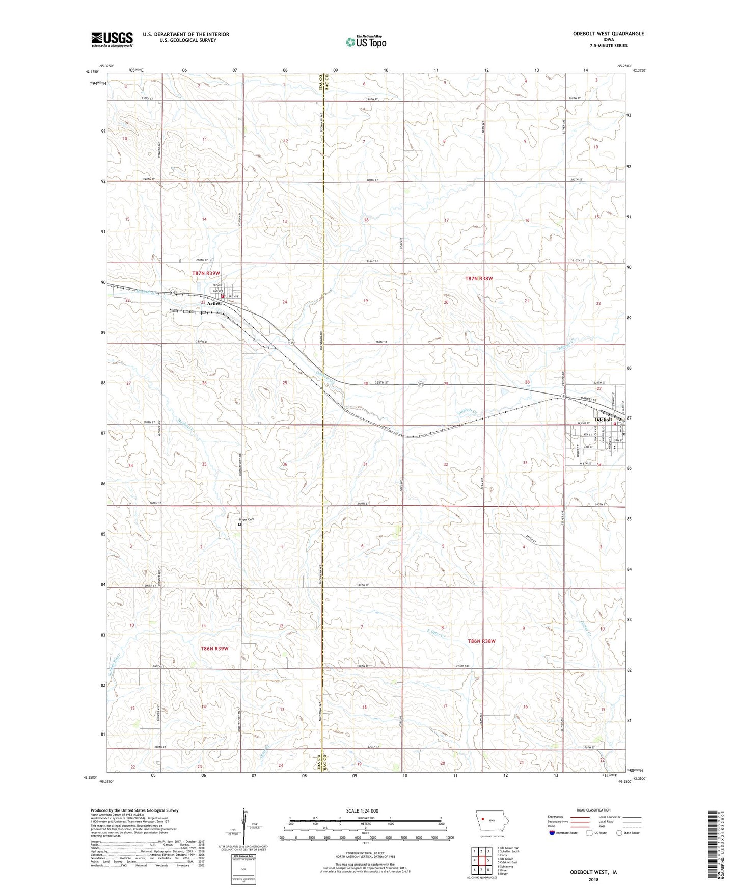
2022 topographic map quadrangle Odebolt West in the state of Iowa. Scale: 1:24000. Based on the newly updated USGS 7.5' US Topo map series, this map is in the following counties: Sac, Ida. The map contains contour data, water features, and other items you are used to seeing on USGS maps, but also has updated roads and other features. This is the next generation of topographic maps. Printed on high-quality waterproof paper with UV fade-resistant inks.
Quads adjacent to this one:
West: Ida Grove
Northwest: Ida Grove NW
North: Schaller South
Northeast: Early
East: Odebolt East
Southeast: Boyer
South: Kiron
Southwest: Schleswig
This map covers the same area as the classic USGS quad with code o42095c3.
Contains the following named places: Arthur, Arthur Church, Arthur City Hall, Arthur Fire Department, Arthur Post Office, Arthur Public Library, City of Arthur, City of Odebolt, Evangelical Free Church, Farmers Co-op Elevator, Hayes Township Cemetery, Methodist Church, Noah Webster Christian Academy, OABCIG Elementary School - Odebolt, OABCIG Middle School, Odebolt, Odebolt City Hall, Odebolt Fire Department, Odebolt Historical Museum, Odebolt Medical Clinic, Odebolt Post Office, Odebolt Public Library, Odebolt-Arthur Middle School, Presbyterian Church, Sac County Golf Club, Saint Martins Catholic Church, Township of Richland, Township of Wheeler, Trinity Lutheran Church, Wall Lake Station, Wheelers Ranch, Winebrenner Church of God, ZIP Code: 51431