MyTopo
Odebolt East Iowa US Topo Map
Couldn't load pickup availability
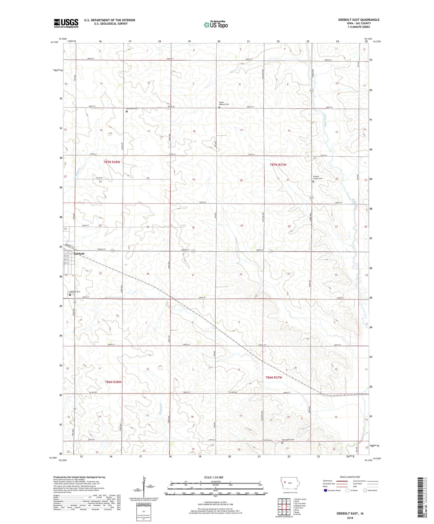
2022 topographic map quadrangle Odebolt East in the state of Iowa. Scale: 1:24000. Based on the newly updated USGS 7.5' US Topo map series, this map is in the following counties: Sac. The map contains contour data, water features, and other items you are used to seeing on USGS maps, but also has updated roads and other features. This is the next generation of topographic maps. Printed on high-quality waterproof paper with UV fade-resistant inks.
Quads adjacent to this one:
West: Odebolt West
Northwest: Schaller South
North: Early
Northeast: Sac City West
East: Lake View
Southeast: Vail NE
South: Boyer
Southwest: Kiron
This map covers the same area as the classic USGS quad with code o42095c2.
Contains the following named places: Clinton Center Cemetery, Faith Lutheran Church, Farmers Co-op Elevator, Odebolt Ambulance Service, Odebolt Cemetery, Odebolt Memorial Walk RV Park, Odebolt Nursing and Rehabilitation Center, Oliver, Oliver Post Office, Philo Post Office, Richland Cemetery, Sac County Golf and Country Club, Salem Reform Cemetery, The Maples, Tom Marks Cemetery, Township of Clinton, Township of Levey, Wheelers Ranch Post Office, ZIP Code: 51458