MyTopo
Bremer Iowa US Topo Map
Couldn't load pickup availability
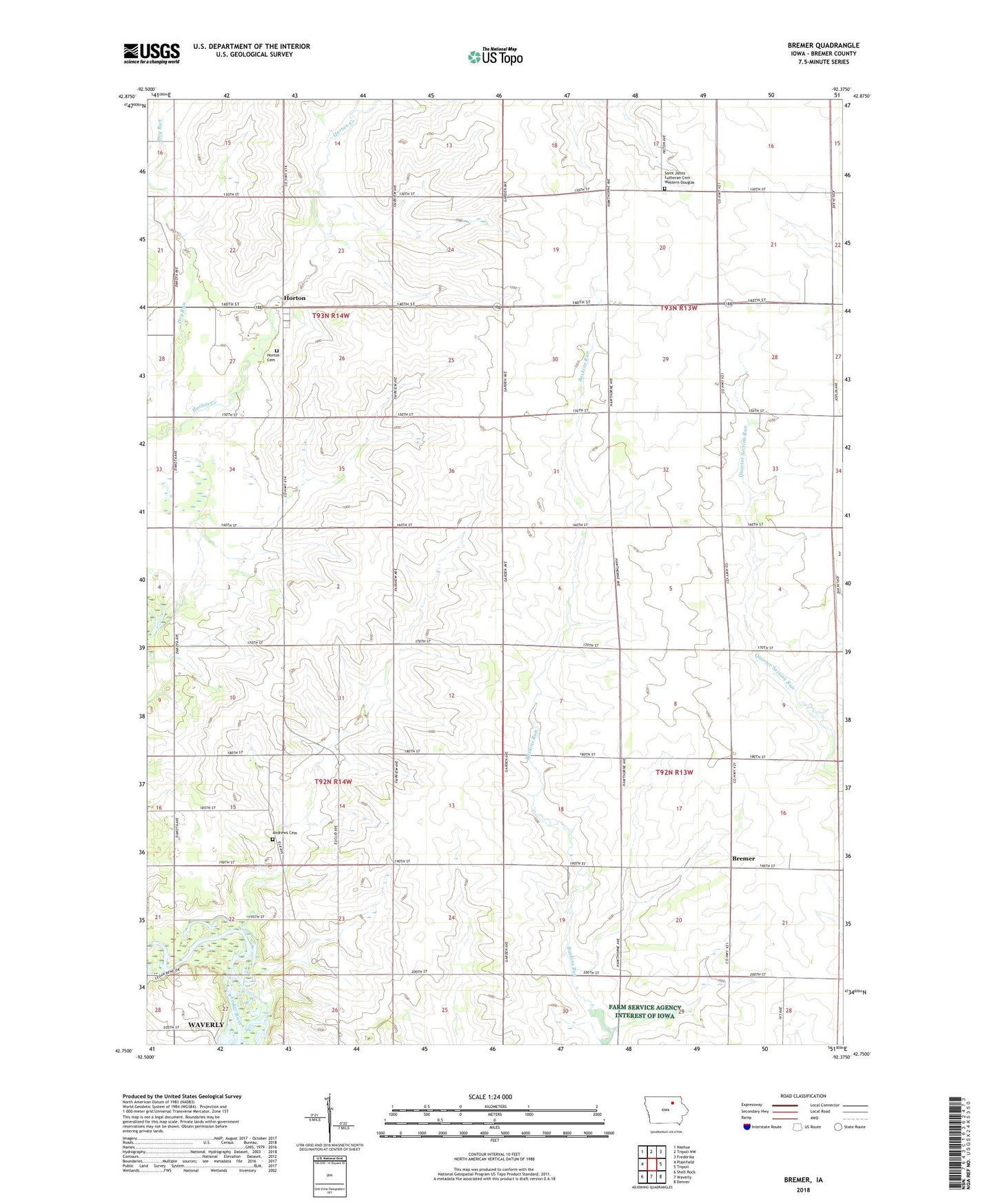
2022 topographic map quadrangle Bremer in the state of Iowa. Scale: 1:24000. Based on the newly updated USGS 7.5' US Topo map series, this map is in the following counties: Bremer. The map contains contour data, water features, and other items you are used to seeing on USGS maps, but also has updated roads and other features. This is the next generation of topographic maps. Printed on high-quality waterproof paper with UV fade-resistant inks.
Quads adjacent to this one:
West: Plainfield
Northwest: Nashua
North: Tripoli NW
Northeast: Frederika
East: Tripoli
Southeast: Denver
South: Waverly
Southwest: Shell Rock
This map covers the same area as the classic USGS quad with code o42092g4.
Contains the following named places: Andrews Cemetery, Bremer, Bremer Post Office, Cedar Bend County Park, Fredericksburg Farmers Co-op Elevator, Horton, Horton Baptist Church, Horton Cemetery, Horton Post Office, Roxie, Roxie Post Office, Saint Johns Lutheran Cemetery, Township of Douglas, Township of Lafayette, Township of Polk, Township of Warren, West Douglas Church, ZIP Code: 50677