MyTopo
Shell Rock Iowa US Topo Map
Couldn't load pickup availability
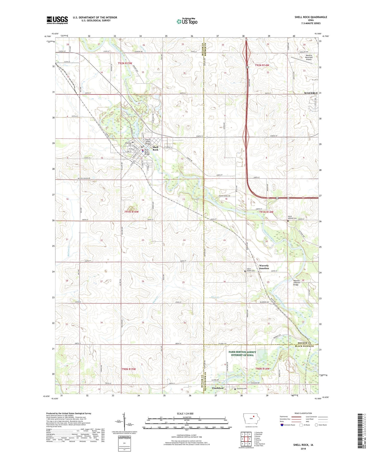
2022 topographic map quadrangle Shell Rock in the state of Iowa. Scale: 1:24000. Based on the newly updated USGS 7.5' US Topo map series, this map is in the following counties: Butler, Bremer, Black Hawk. The map contains contour data, water features, and other items you are used to seeing on USGS maps, but also has updated roads and other features. This is the next generation of topographic maps. Printed on high-quality waterproof paper with UV fade-resistant inks.
Quads adjacent to this one:
West: Coster
Northwest: Clarksville
North: Plainfield
Northeast: Bremer
East: Waverly
Southeast: Cedar Falls
South: New Hartford
Southwest: Stout
This map covers the same area as the classic USGS quad with code o42092f5.
Contains the following named places: Benny Gambaiani Public Library, Camp Heyata, Camp Wahpaton, Cherry Street Bridge, City of Shell Rock, Curry Creek, Faith Lutheran Church, Family Health Center - Shell Rock, Farmers Co-op Elevator, Finchford, Finchford Cemetery, Finchford Community Church, Finchford Post Office, First Baptist Church, Jehovahs Witnesses Kingdom Hall, Klock Creek, Maxwell Chiropractic Clinic, Peace Lutheran Church, Pilot Mound Cemetery, Riverside Cemetery, Shell Rock, Shell Rock Access Area, Shell Rock Ambulance Service, Shell Rock Bridge, Shell Rock County Park, Shell Rock Elementary School, Shell Rock Fire Station, Shell Rock Health Care Center, Shell Rock Police Department, Shell Rock Post Office, Shell Rock River, Shell Rock Wildlife Area, Thunder Woman County Park, Township of Shell Rock, United Methodist Church, Waverly Junction, Waverly Junction Bridge, Waverly Junction Post Office, Waverly Municipal Airport, West Pilot Cemetery, Winslow Post Office, ZIP Code: 50670