MyTopo
Frederika Iowa US Topo Map
Couldn't load pickup availability
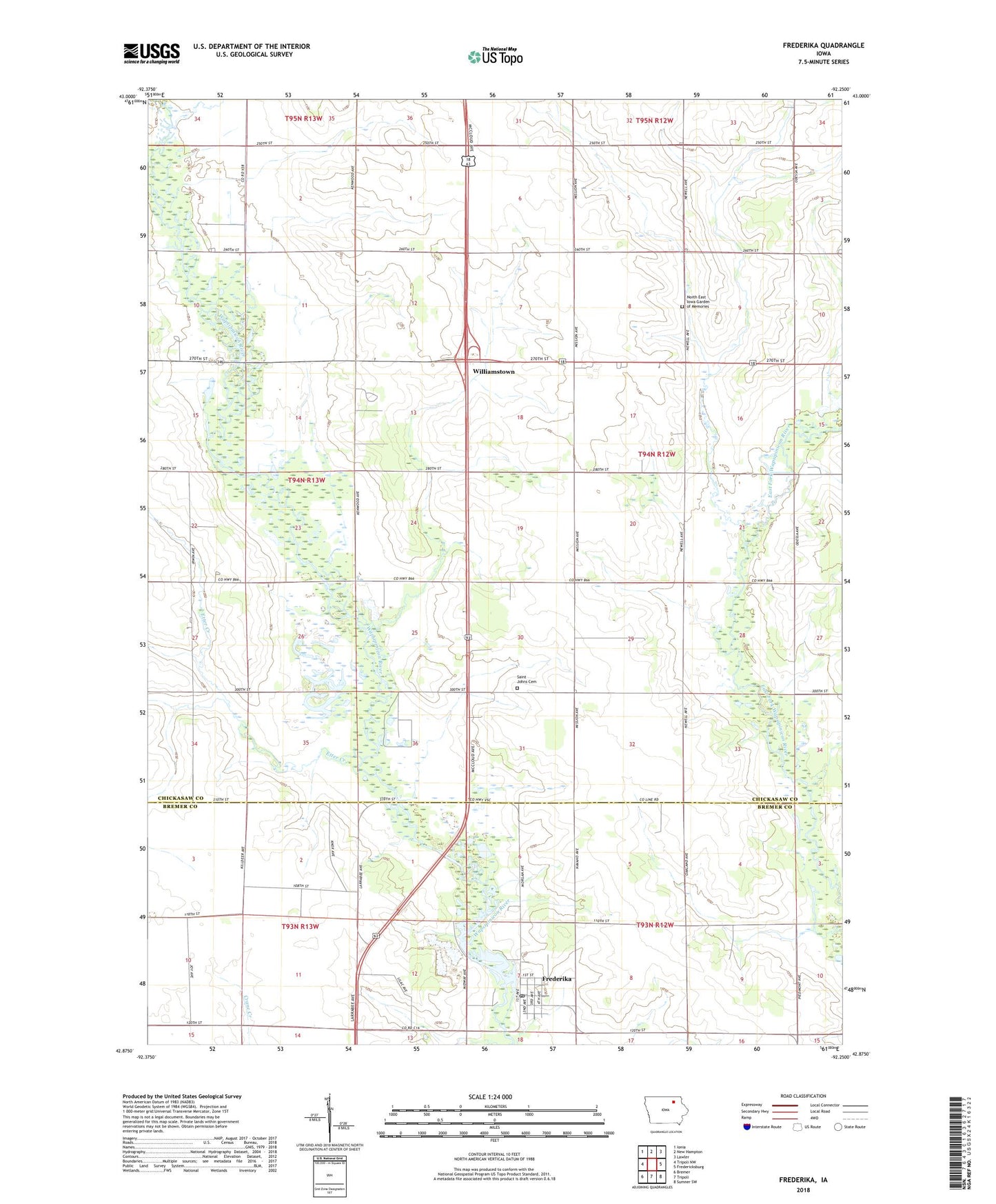
2022 topographic map quadrangle Frederika in the state of Iowa. Scale: 1:24000. Based on the newly updated USGS 7.5' US Topo map series, this map is in the following counties: Chickasaw, Bremer. The map contains contour data, water features, and other items you are used to seeing on USGS maps, but also has updated roads and other features. This is the next generation of topographic maps. Printed on high-quality waterproof paper with UV fade-resistant inks.
Quads adjacent to this one:
West: Tripoli NW
Northwest: Ionia
North: New Hampton
Northeast: Lawler
East: Fredericksburg
Southeast: Sumner SW
South: Tripoli
Southwest: Bremer
This map covers the same area as the classic USGS quad with code o42092h3.
Contains the following named places: Alcock County Park, City of Frederika, Dresden, Dresden Post Office, Etter Creek, Fredericksburg Farmers Co-op Elevator, Frederika, Frederika City Park, Frederika Methodist Church, Frederika Post Office, Frederika Quarry, Frederika Town Hall, Frederika Volunteer Fire Department, Justen Wildlife Area, North East Iowa Garden of Memories, Odessa Avenue Park, Saint Johns Cemetery, Saint Johns Lutheran Church, Spring Branch, Township of Dresden, Williamstown, Williamstown Church, Williamstown Post Office