MyTopo
Buffalo Center Iowa US Topo Map
Couldn't load pickup availability
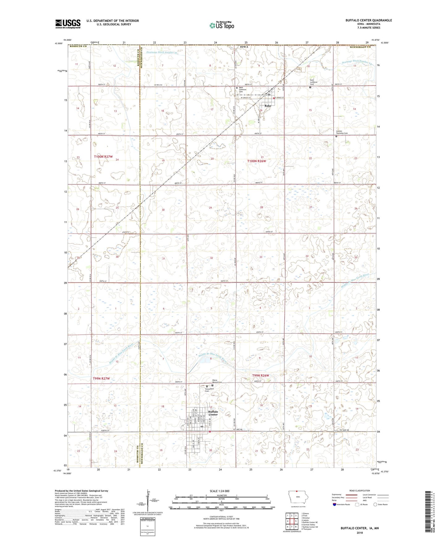
2022 topographic map quadrangle Buffalo Center in the state of Iowa. Scale: 1:24000. Based on the newly updated USGS 7.5' US Topo map series, this map is in the following counties: Winnebago, Kossuth, Faribault. The map contains contour data, water features, and other items you are used to seeing on USGS maps, but also has updated roads and other features. This is the next generation of topographic maps. Printed on high-quality waterproof paper with UV fade-resistant inks.
Quads adjacent to this one:
West: Lakota
Northwest: Elmore
North: Frost
Northeast: Bricelyn
East: Buffalo Center NE
Southeast: Thompson
South: Buffalo Center SW
Southwest: German Valley
Contains the following named places: Bethlehem Lutheran Church, Buffalo Center, Buffalo Center Chiropractic, Buffalo Center Fire Department, Buffalo Center Post Office, Buffalo Center Public Library, Buffalo Center Volunteer Ambulance Service, City of Buffalo Center, City of Rake, Congregational Church, Drainage Ditch Number 21, Drainage Ditch Number 64, East Cemetery, Farmers Co-op Elevator, First Baptist Church, First Reformed Church, Graceland Cemetery, Lincoln Township Cemetery, Lions Park, Mercy Family Care - Buffalo Center, North Iowa Community School, North Iowa High School, North Iowa Middle School, Northland Cooperative Elevator, Olena Mound Cemetery, Quam Wildlife Area, Rake, Rake Airport, Rake City Town Hall, Rake Fire Department, Rake First Responders, Rake Post Office, Rake Public Library, Saint Patricks Church, Timely Mission Nursing Home, Township of Buffalo, Township of Lincoln, United Methodist Church, West Cemetery, Zion Lutheran Church, ZIP Codes: 50424, 50465