MyTopo
Elmore Minnesota US Topo Map
Couldn't load pickup availability
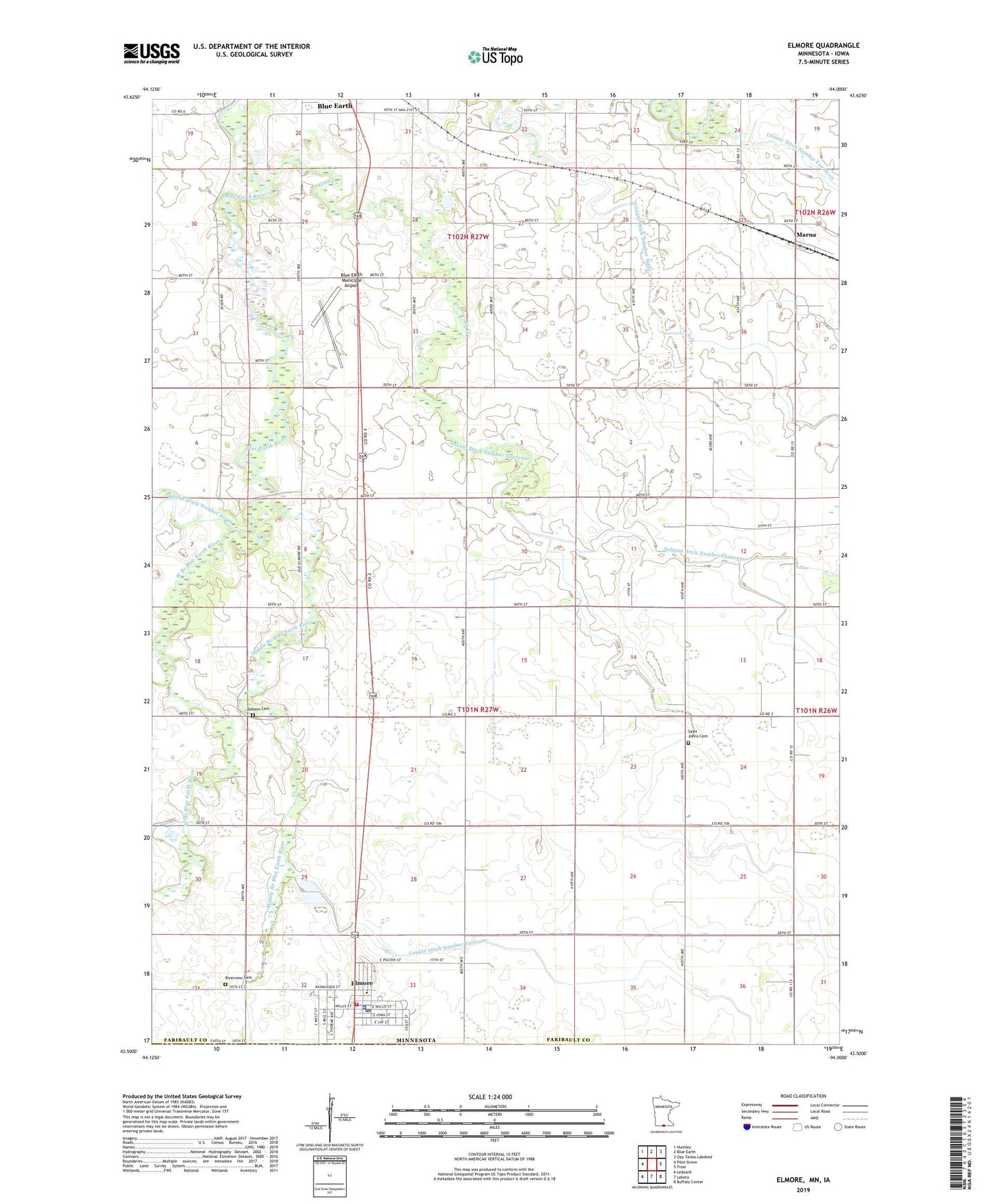
2022 topographic map quadrangle Elmore in the state of Minnesota. Scale: 1:24000. Based on the newly updated USGS 7.5' US Topo map series, this map is in the following counties: Faribault, Kossuth. The map contains contour data, water features, and other items you are used to seeing on USGS maps, but also has updated roads and other features. This is the next generation of topographic maps. Printed on high-quality waterproof paper with UV fade-resistant inks.
Quads adjacent to this one:
West: Pilot Grove
Northwest: Huntley
North: Blue Earth
Northeast: Oza Tanka Lakebed
East: Frost
Southeast: Buffalo Center
South: Lakota
Southwest: Ledyard
This map covers the same area as the classic USGS quad with code o43094e1.
Contains the following named places: Blue Earth Municipal Airport, Browns Lake, City of Elmore, Coon Creek, County Ditch Number Eight, County Ditch Number Eighty, County Ditch Number Fortyone, County Ditch Number Twentysix, Dobson Cemetery, Elmore, Elmore City Volunteer Fire Department, Elmore Library, Elmore Police Department, Elmore Post Office, Faribault County United Clinics, Hesse Burying Grounds, Judicial Ditch Number Thirteen, Marna, Marna Post Office, Middle Branch Blue Earth River, Minn Iowa Golf Course, Moses Sailor First Settler Commemorative Monument, Riverview Cemetery, Saint Johns Cemetery, Saint Johns Church, Shiloh Lutheran Church, Sohn Dairy, State Line Wayside Park, Township of Elmore, Trinity Lutheran Church, United Methodist Church, Van Buren Cemetery, West Branch Blue Earth River, Wood Lake Park, ZIP Codes: 56013, 56027