MyTopo
Thompson Iowa US Topo Map
Couldn't load pickup availability
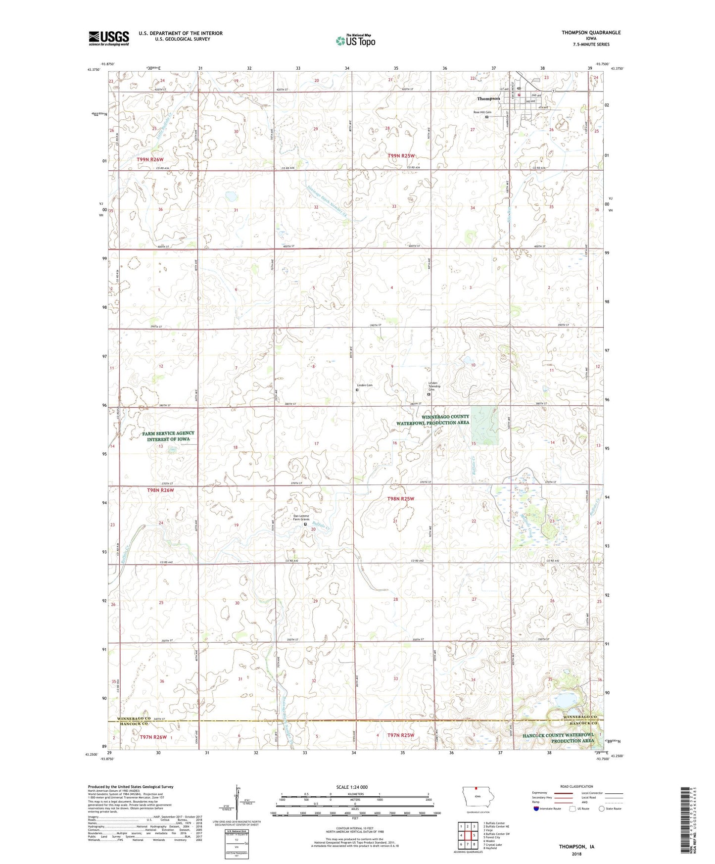
2022 topographic map quadrangle Thompson in the state of Iowa. Scale: 1:24000. Based on the newly updated USGS 7.5' US Topo map series, this map is in the following counties: Winnebago, Hancock. The map contains contour data, water features, and other items you are used to seeing on USGS maps, but also has updated roads and other features. This is the next generation of topographic maps. Printed on high-quality waterproof paper with UV fade-resistant inks.
Quads adjacent to this one:
West: Buffalo Center SW
Northwest: Buffalo Center
North: Buffalo Center NE
Northeast: Vinje
East: Forest City
Southeast: Hayfield
South: Crystal Lake
Southwest: Woden
This map covers the same area as the classic USGS quad with code o43093c7.
Contains the following named places: Bethany Lutheran Church, City of Thompson, Dan Lemme Farm Graves, Drainage Ditch Number 24, Drainage Ditch Number 39, Grant Church, Halverson Landing Strip, Hollandale Post Office, Linden Church, Linden Lutheran Cemetery, Linden Township Cemetery, Linden Township Cemetery Prairie, Luke Rossiter Wildlife Area, Methodist Church, Mount Valley, Myre Slough State Game Management Area, North Iowa Alternative High School, Northland Cooperative Elevator, Rose Hill Cemetery, Russ Wildlife Area, Thompson, Thompson Ambulance Service, Thompson Fire Department, Thompson Post Office, Thompson Public Library, Thorpe Park, Township of Linden, Winnebago County Fairgrounds, Zion Evangelical Lutheran Church