MyTopo
Carson Iowa US Topo Map
Couldn't load pickup availability
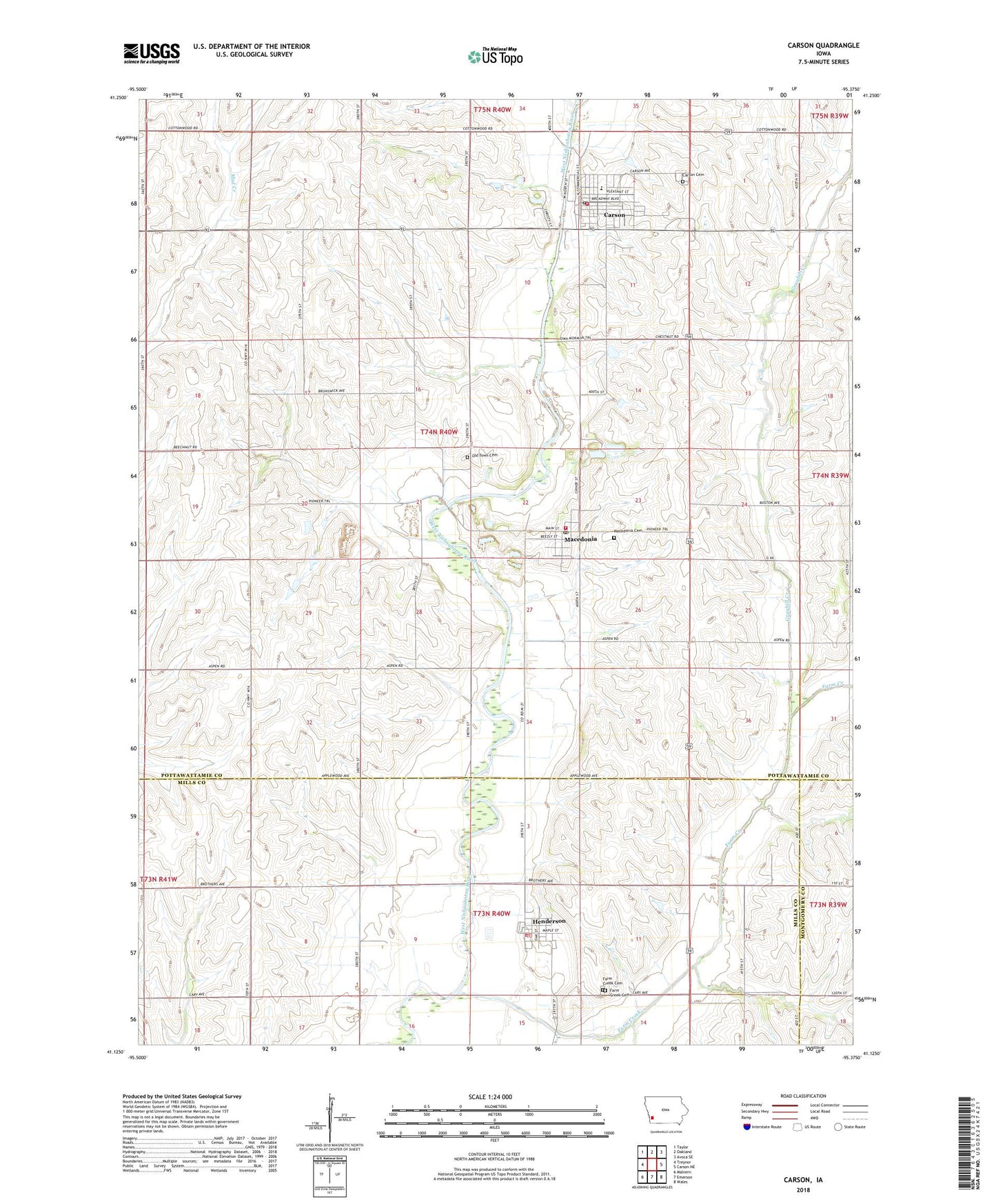
2022 topographic map quadrangle Carson in the state of Iowa. Scale: 1:24000. Based on the newly updated USGS 7.5' US Topo map series, this map is in the following counties: Pottawattamie, Mills, Montgomery. The map contains contour data, water features, and other items you are used to seeing on USGS maps, but also has updated roads and other features. This is the next generation of topographic maps. Printed on high-quality waterproof paper with UV fade-resistant inks.
Quads adjacent to this one:
West: Treynor
Northwest: Taylor
North: Oakland
Northeast: Avoca SE
East: Carson NE
Southeast: Wales
South: Emerson
Southwest: Malvern
This map covers the same area as the classic USGS quad with code o41095b4.
Contains the following named places: Carson, Carson Cemetery, Carson City Hall, Carson Fire and Rescue, Carson Post Office, Carson Presbyterian Church, City of Carson, City of Henderson, City of Macedonia, Farm Creek, Farm Creek Cemetery, Farmer Service Company Co-op Elevator, Graybill Creek, Henderson, Henderson Christian Church, Henderson Fire Department, Henderson Post Office, Macedonia, Macedonia Cemetery, Macedonia City Hall, Macedonia Post Office, Macedonia Quarry, Macedonia Volunteer Fire Department, Old Town Cemetery, Olde Town County Park, Reorganized Church of Jesus Christ of Latter Day Saints, Riverside Community South Elementary School, Riverside Intermediate School, Township of Carson, Township of Macedonia, United Methodist Church, ZIP Codes: 51525, 51541, 51549