MyTopo
Treynor Iowa US Topo Map
Couldn't load pickup availability
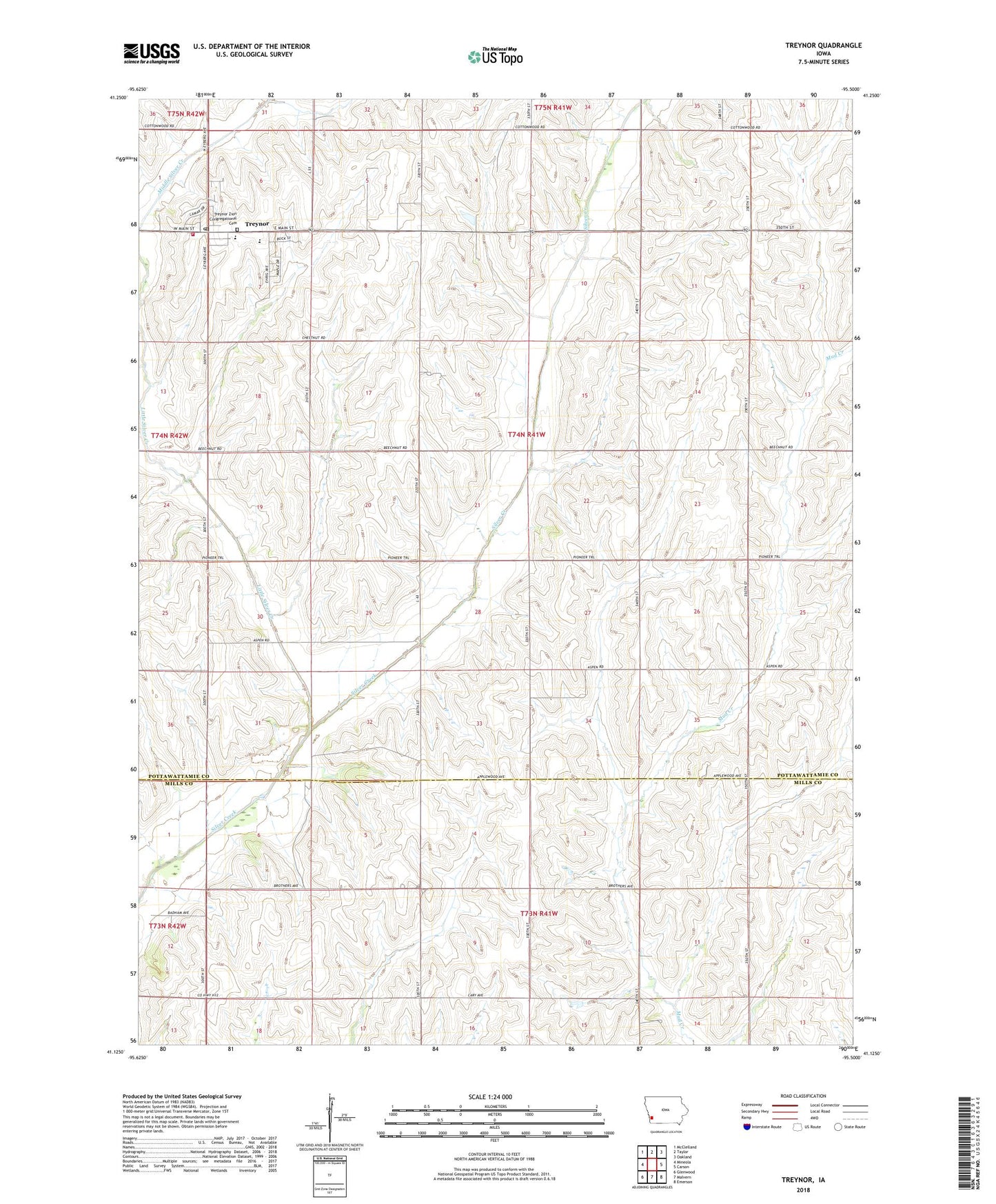
2022 topographic map quadrangle Treynor in the state of Iowa. Scale: 1:24000. Based on the newly updated USGS 7.5' US Topo map series, this map is in the following counties: Pottawattamie, Mills. The map contains contour data, water features, and other items you are used to seeing on USGS maps, but also has updated roads and other features. This is the next generation of topographic maps. Printed on high-quality waterproof paper with UV fade-resistant inks.
Quads adjacent to this one:
West: Mineola
Northwest: McClelland
North: Taylor
Northeast: Oakland
East: Carson
Southeast: Emerson
South: Malvern
Southwest: Glenwood
This map covers the same area as the classic USGS quad with code o41095b5.
Contains the following named places: Boxelder Post Office, Boxelder School, City of Treynor, Little Silver Creek, Living Spring, Living Spring Post Office, Middle Silver Creek, Ridge Family Practice Center, Saint Pauls Lutheran Church, Township of Silver Creek, Treynor, Treynor City Town Hall, Treynor Elementary School, Treynor Fire Department and Ambulance Service, Treynor High School, Treynor Post Office, Treynor Recreation Area, Zion Congregational Cemetery, Zion Congregational Church, ZIP Codes: 51571, 51575