MyTopo
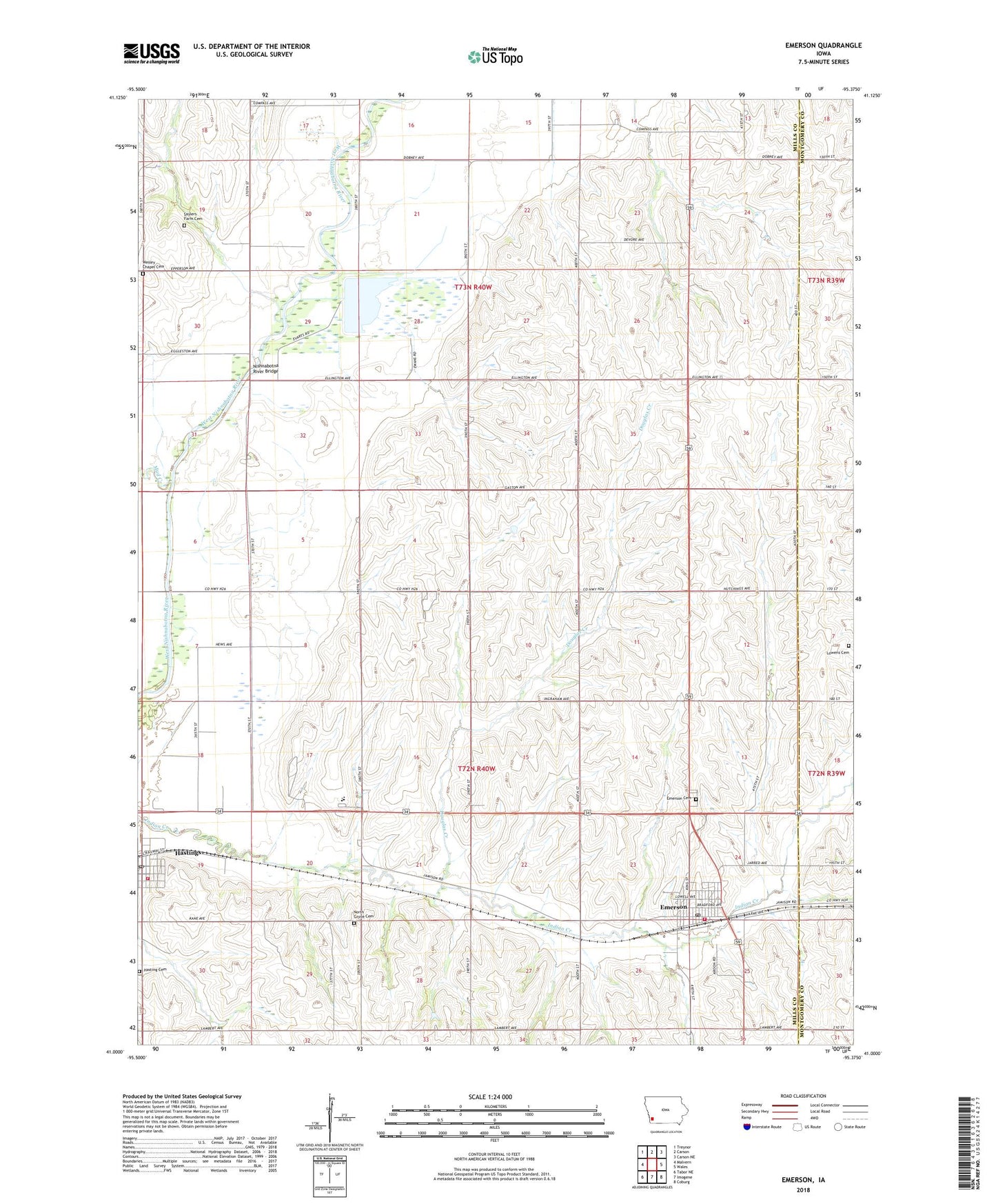
Emerson Iowa US Topo Map
Couldn't load pickup availability
2022 topographic map quadrangle Emerson in the state of Iowa. Scale: 1:24000. Based on the newly updated USGS 7.5' US Topo map series, this map is in the following counties: Mills, Montgomery. The map contains contour data, water features, and other items you are used to seeing on USGS maps, but also has updated roads and other features. This is the next generation of topographic maps. Printed on high-quality waterproof paper with UV fade-resistant inks.
Quads adjacent to this one:
West: Malvern
Northwest: Treynor
North: Carson
Northeast: Carson NE
East: Wales
Southeast: Coburg
South: Imogene
Southwest: Tabor NE
This map covers the same area as the classic USGS quad with code o41095a4.
Contains the following named places: Bass Memorial Park, City of Emerson, City of Hastings, Douglas Creek, East Mills Elementary School, East Mills Junior / Senior School, Emerson, Emerson Cemetery, Emerson City Hall, Emerson Post Office, Emerson Public Library, Emerson Volunteer Fire and Rescue Department, First Baptist Church, Hastings, Hastings Cemetery, Hastings Fire and Rescue, Hastings Post Office, Highway Number Thirty-Four Roadside Park, Indian Creek Post Office, Lake George, Lowens Cemetery, Mud Creek, Nishnabotna River Bridge, North Grove Cemetery, Oaks Church, Saylers Farm Cemetery, Township of Anderson, Township of Indian Creek, United Methodist Church, Wales United Presbyterian Church, Wesley Chapel Cemetery, Willow Slough Dam, Willow Slough State Game Management Area, ZIP Codes: 51533, 51540