MyTopo
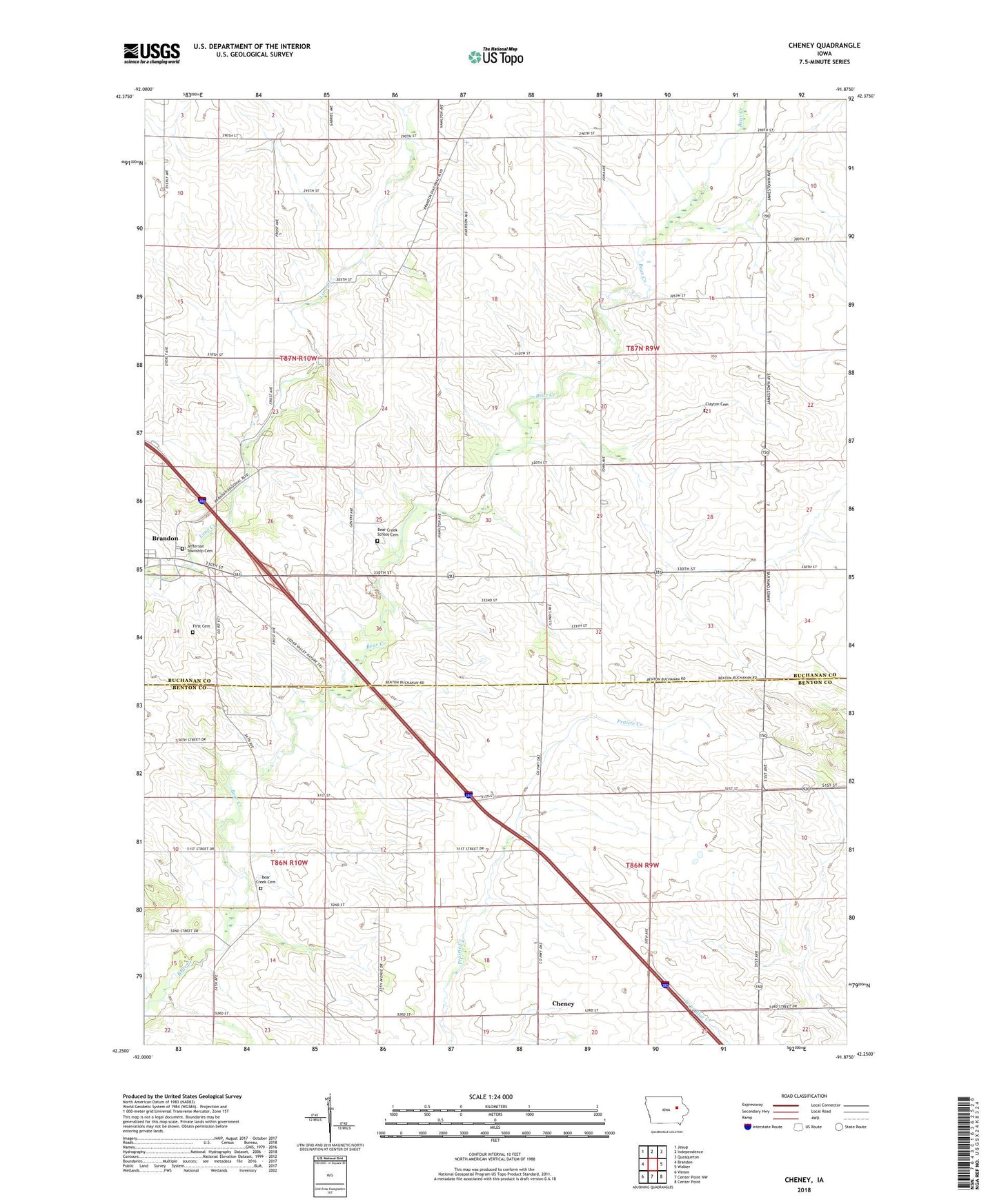
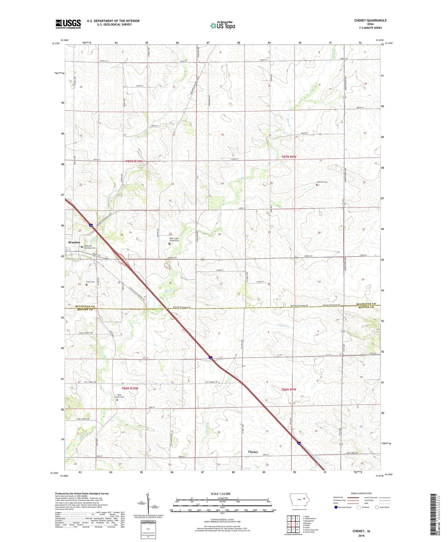
Cheney Iowa US Topo Map
Couldn't load pickup availability
2022 topographic map quadrangle Cheney in the state of Iowa. Scale: 1:24000. Based on the newly updated USGS 7.5' US Topo map series, this map is in the following counties: Buchanan, Benton. The map contains contour data, water features, and other items you are used to seeing on USGS maps, but also has updated roads and other features. This is the next generation of topographic maps. Printed on high-quality waterproof paper with UV fade-resistant inks.
Quads adjacent to this one:
West: Brandon
Northwest: Jesup
North: Independence
Northeast: Quasqueton
East: Walker
Southeast: Center Point
South: Center Point NW
Southwest: Vinton
This map covers the same area as the classic USGS quad with code o42091c8.
Contains the following named places: Beachler Cemetery, Bear Creek Cemetery, Bear Creek School Cemetery, Bearbower Sand Prairie Area, Burke Post Office, Cheney, Clayton Cemetery, Hamerville, Hamerville Post Office, Harrison Townhall, Jefferson Township Cemetery, KGAN-TV (Cedar Rapids), Kounty Pond - Hoffman Woods Area, Likins Post Office, Lime Creek County Park, Polk Township Wildlife Area, Township of Harrison, Township of Homer, ZIP Code: 52210