MyTopo
Clare Iowa US Topo Map
Couldn't load pickup availability
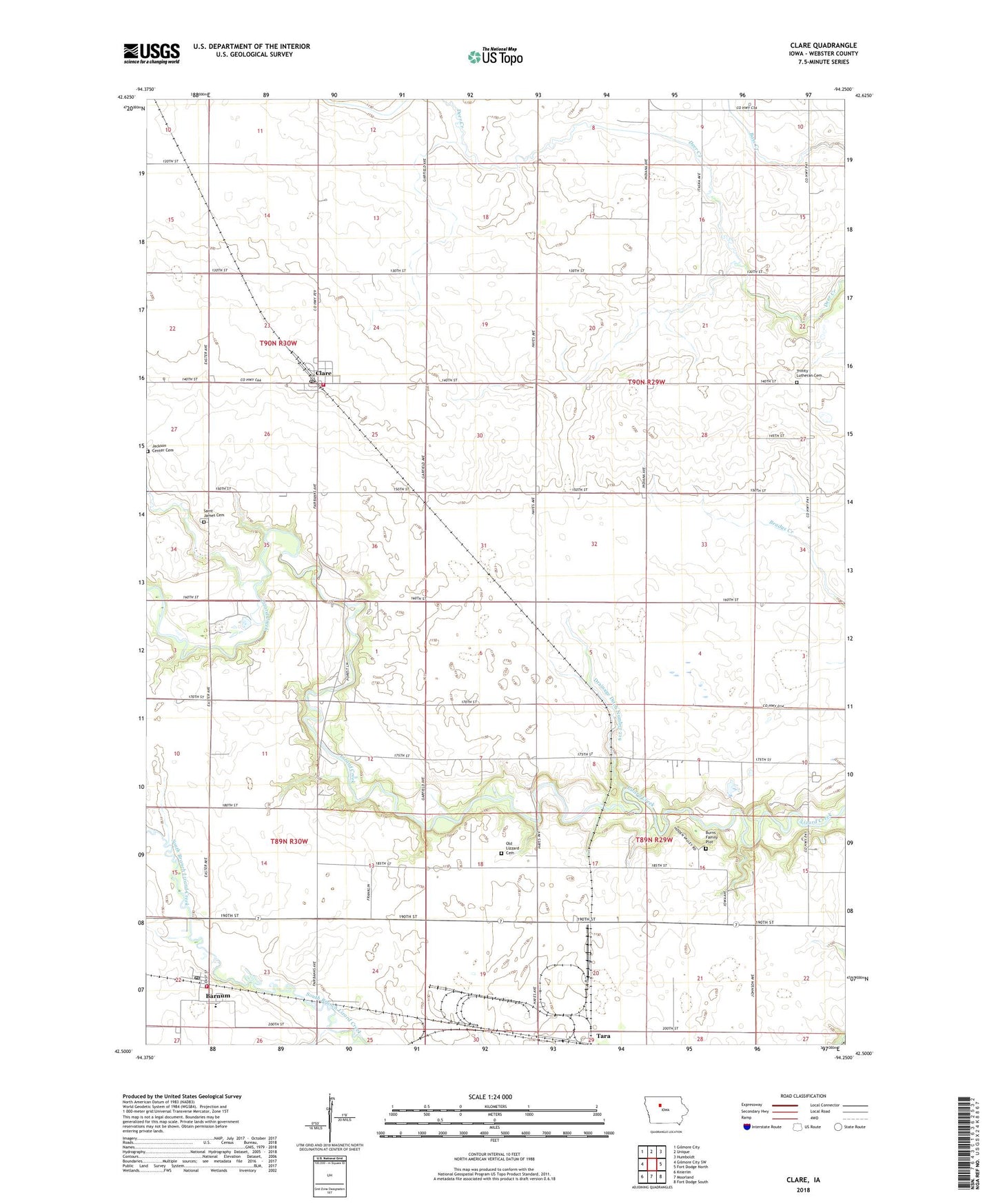
2022 topographic map quadrangle Clare in the state of Iowa. Scale: 1:24000. Based on the newly updated USGS 7.5' US Topo map series, this map is in the following counties: Webster. The map contains contour data, water features, and other items you are used to seeing on USGS maps, but also has updated roads and other features. This is the next generation of topographic maps. Printed on high-quality waterproof paper with UV fade-resistant inks.
Quads adjacent to this one:
West: Gilmore City SW
Northwest: Gilmore City
North: Unique
Northeast: Humboldt
East: Fort Dodge North
Southeast: Fort Dodge South
South: Moorland
Southwest: Knierim
This map covers the same area as the classic USGS quad with code o42094e3.
Contains the following named places: Barnum, Barnum Fire Department, Barnum Post Office, Burns Family Plot, City of Barnum, City of Clare, Clare, Clare City Community Center, Clare City Hall, Clare City Library, Clare Fire Department, Clare Post Office, Clare Rescue, Deer Creek Township Hall, Drainage Ditch Number 219, Jackson Center Cemetery, Jerry Rabiner Boys Home, Manson Northwest Webster Elementary School, Old Lizard Cemetery, Saint James Cemetery, Saint Matthew's Catholic Church, Tara, Township of Deer Creek, Township of Douglas, Trinity Lutheran Cemetery, Trinity Lutheran Church, Trinity Luthrean School, ZIP Code: 50524