MyTopo
Clio Iowa US Topo Map
Couldn't load pickup availability
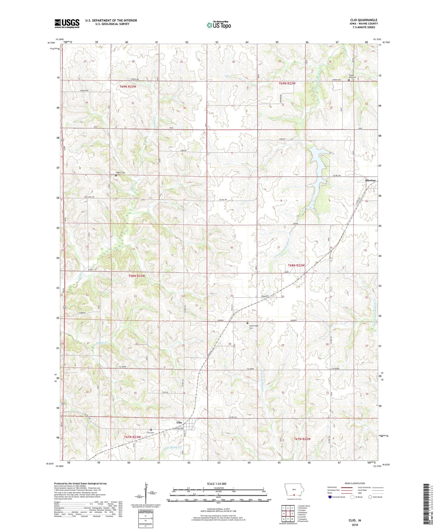
2022 topographic map quadrangle Clio in the state of Iowa. Scale: 1:24000. Based on the newly updated USGS 7.5' US Topo map series, this map is in the following counties: Wayne. The map contains contour data, water features, and other items you are used to seeing on USGS maps, but also has updated roads and other features. This is the next generation of topographic maps. Printed on high-quality waterproof paper with UV fade-resistant inks.
Quads adjacent to this one:
West: Woodland
Northwest: Garden Grove
North: Humeston
Northeast: Corydon
East: Allerton
Southeast: Powersville
South: Cleopatra
Southwest: Lineville
This map covers the same area as the classic USGS quad with code o40093f4.
Contains the following named places: Bob White State Park, City of Clio, Clio, Clio Cemetery, Clio Post Office, Greenridge Cemetery, Hazel Dell Cemetery, Higley Cemetery, Hodge, Hodge Post Office, Shriver Cemetery, Township of Jefferson, Township of Warren, ZIP Codes: 50008, 50052