MyTopo
Humeston Iowa US Topo Map
Couldn't load pickup availability
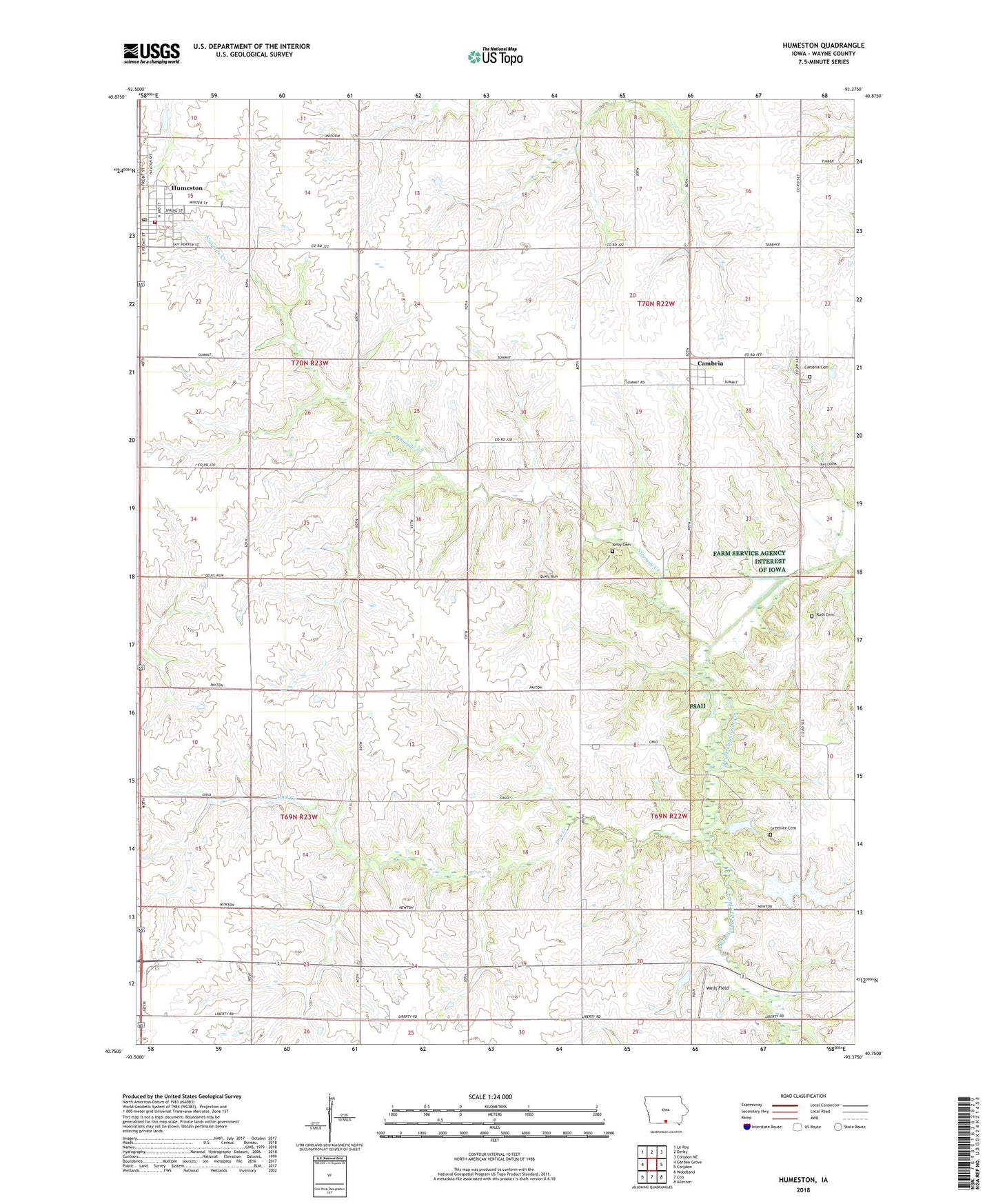
2022 topographic map quadrangle Humeston in the state of Iowa. Scale: 1:24000. Based on the newly updated USGS 7.5' US Topo map series, this map is in the following counties: Wayne. The map contains contour data, water features, and other items you are used to seeing on USGS maps, but also has updated roads and other features. This is the next generation of topographic maps. Printed on high-quality waterproof paper with UV fade-resistant inks.
Quads adjacent to this one:
West: Garden Grove
Northwest: Le Roy
North: Derby
Northeast: Corydon NE
East: Corydon
Southeast: Allerton
South: Clio
Southwest: Woodland
This map covers the same area as the classic USGS quad with code o40093g4.
Contains the following named places: Benton Center School, Brown Jug School, Cambria, Cambria Cemetery, Cambria Post Office, Christian United Methodist Church, City of Humeston, Clay Center School, Dick Creek, Fairyview School, First Baptist Church, First Presbyterian Church, Greenlee Cemetery, Humeston, Humeston Fire Department, Humeston First Responders, Humeston Library, Humeston Medical Clinic, Humeston Post Office, Kirby Cemetery, Locust Grove School, Lucerne, Lucerne Post Office, Lucerne School, Maple Grove School, New Zion Church, Ninemile Creek, Orlando Post Office, Railroad right-of-way Public Hunting Area, Rush Cemetery, Saxon, Saxon Post Office, Township of Benton, Township of Clay, Township of Richman, Township of Washington, Wells Field, Willow Grove School, Wolf Hollow Wildlife Area