MyTopo
Garden Grove Iowa US Topo Map
Couldn't load pickup availability
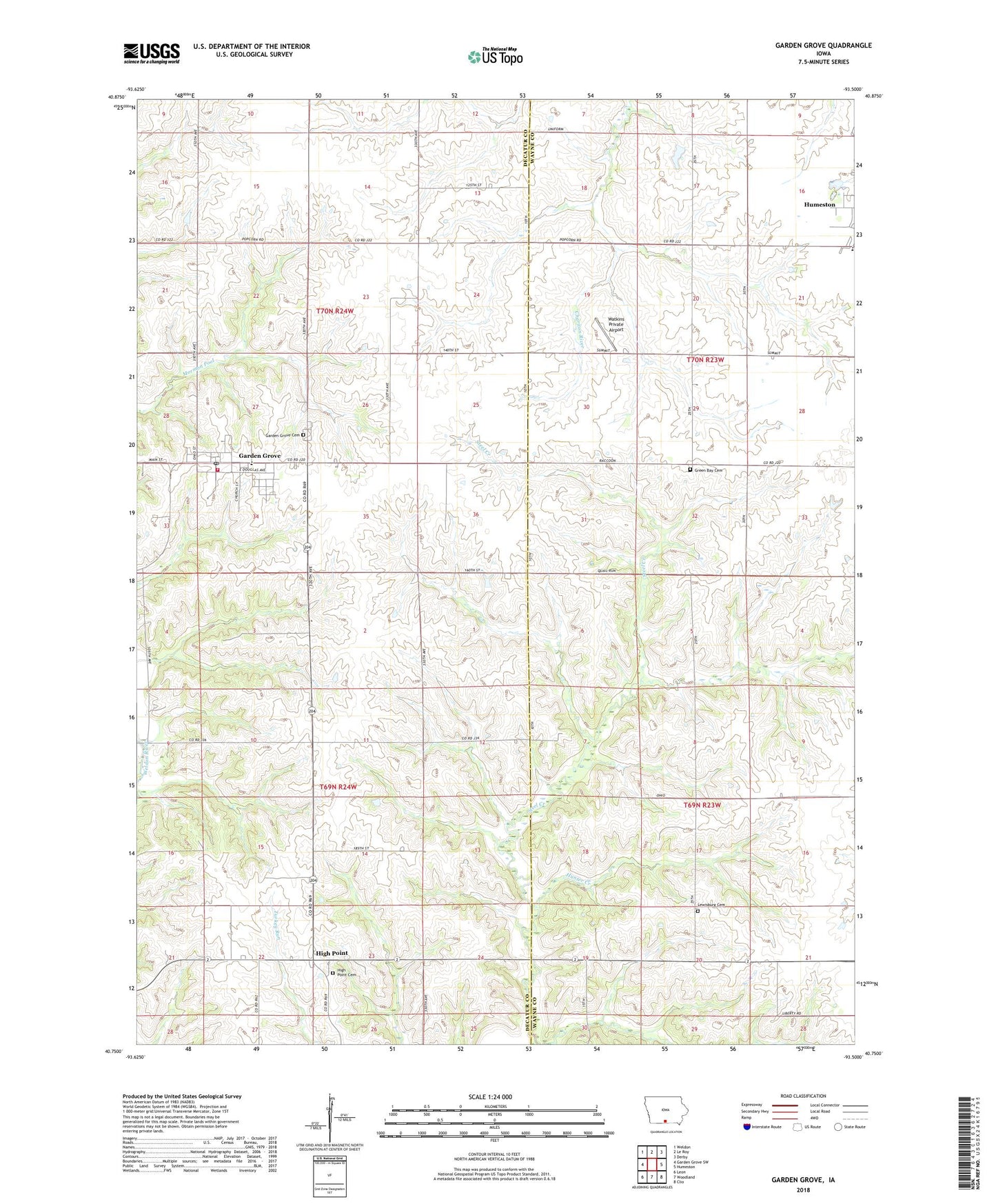
2022 topographic map quadrangle Garden Grove in the state of Iowa. Scale: 1:24000. Based on the newly updated USGS 7.5' US Topo map series, this map is in the following counties: Decatur, Wayne. The map contains contour data, water features, and other items you are used to seeing on USGS maps, but also has updated roads and other features. This is the next generation of topographic maps. Printed on high-quality waterproof paper with UV fade-resistant inks.
Quads adjacent to this one:
West: Garden Grove SW
Northwest: Weldon
North: Le Roy
Northeast: Derby
East: Humeston
Southeast: Clio
South: Woodland
Southwest: Leon
This map covers the same area as the classic USGS quad with code o40093g5.
Contains the following named places: City of Garden Grove, Garden Grove, Garden Grove Cemetery, Garden Grove City Hall, Garden Grove Fire Department and Emergency Medical Services, Garden Grove Post Office, Green Bay Cemetery, High Point, High Point Cemetery, Highpoint Post Office, Hunter Creek, Lewisburg Cemetery, Lewisburg Post Office, Mormon Pioneer Historic Trailside Park, Mormon Trail Elementary School, Mormon Trail Junior / Senior High School, Township of Garden Grove, Township of High Point, Unity Church, Watkins Private Airport, ZIP Codes: 50103, 50123