MyTopo
Lineville Iowa US Topo Map
Couldn't load pickup availability
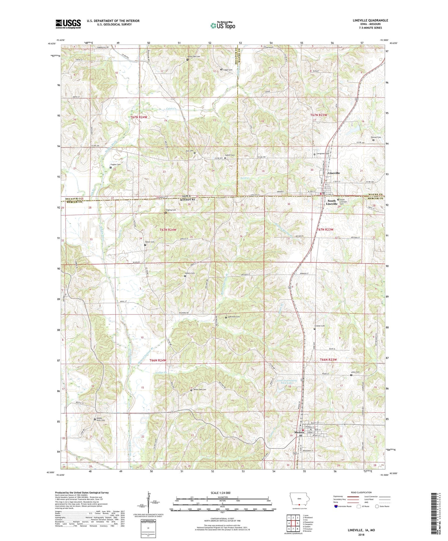
2022 topographic map quadrangle Lineville in the states of Missouri, Iowa. Scale: 1:24000. Based on the newly updated USGS 7.5' US Topo map series, this map is in the following counties: Decatur, Wayne, Mercer. The map contains contour data, water features, and other items you are used to seeing on USGS maps, but also has updated roads and other features. This is the next generation of topographic maps. Printed on high-quality waterproof paper with UV fade-resistant inks.
Quads adjacent to this one:
West: Pleasanton
Northwest: Leon
North: Woodland
Northeast: Clio
East: Cleopatra
Southeast: Ravanna
South: Princeton
Southwest: Goshen
Contains the following named places: Alley Cemetery, Brush Creek, Caleb Creek, City of Lineville, Collier Branch, Duncan Cemetery, Duncan School, Elm Cemetery, Evergreen Cemetery, Fugate Cemetery, Garland School, Gatliff Cemetery, Girdner Cemetery, Hickory School, Hollars Cemetery, Lick Branch, Lineville, Lineville Baptist Church, Lineville Christian Church, Lineville City Hall, Lineville Medical Clinic, Lineville Post Office, Lineville Volunteer Fire Department, Lineville-Clio Junior-Senior High School, Lions Community Park, Lions Community Park Lake, Lions Community Park Lake Dam, Logan Cemetery, McKinney Cemetery, Mercer, Mercer High School, Mercer Post Office, Mercer Volunteer Fire Department, Middle Point Cemetery, Middle Point School, Mineral Springs Branch, Moore Cemetery, Moore-Gosch Memorial Park, Morgan, Morgan Post Office, North Mercer Elementary School, Ragan Branch, Sand Creek, South Lineville, South Lineville Cemetery, Steel Creek, Town of Mercer, Town of South Lineville, Township of Marion, Township of Morgan, Upper Girdner School, White Oak Cemetery, White Oak School, Yingling Cemetery, ZIP Code: 64661