MyTopo
Cornelia Iowa US Topo Map
Couldn't load pickup availability
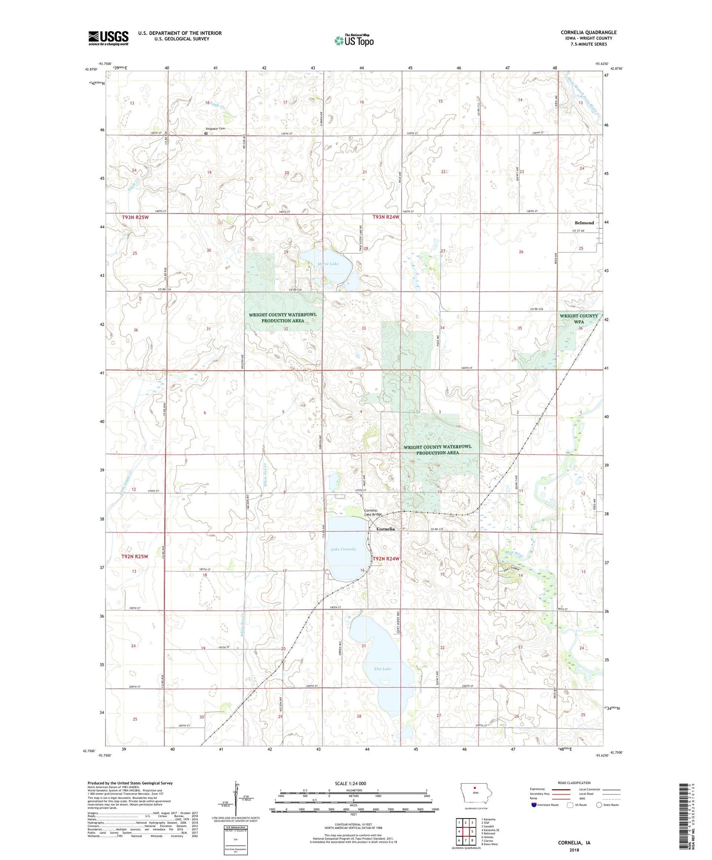
2022 topographic map quadrangle Cornelia in the state of Iowa. Scale: 1:24000. Based on the newly updated USGS 7.5' US Topo map series, this map is in the following counties: Wright. The map contains contour data, water features, and other items you are used to seeing on USGS maps, but also has updated roads and other features. This is the next generation of topographic maps. Printed on high-quality waterproof paper with UV fade-resistant inks.
Quads adjacent to this one:
West: Kanawha SE
Northwest: Kanawha
North: Olaf
Northeast: Goodell
East: Belmond
Southeast: Dows West
South: Clarion
Southwest: Holmes
This map covers the same area as the classic USGS quad with code o42093g6.
Contains the following named places: Cambier River Bend Area, Cornelia, Cornelia Lake Bridge, Cornelia Post Office, Dayspring Assembly of God Church, Elm Lake, Elm Lake Wildlife Management Area, Lake Cornelia, Lake Cornelia State Game Management Area, Lower Morse Lake Waterfowl Production Area, Morse Lake, Morse Lake Wildlife Management Area, Pikes Timber Park, Ringsaker Cemetery, Rolling Acres Potholes, Saint Olaf Church, Saint Olaf Lutheran Church, Township of Belmond, Township of Grant, Wright County Waterfowl Production Area