MyTopo
Dows West Iowa US Topo Map
Couldn't load pickup availability
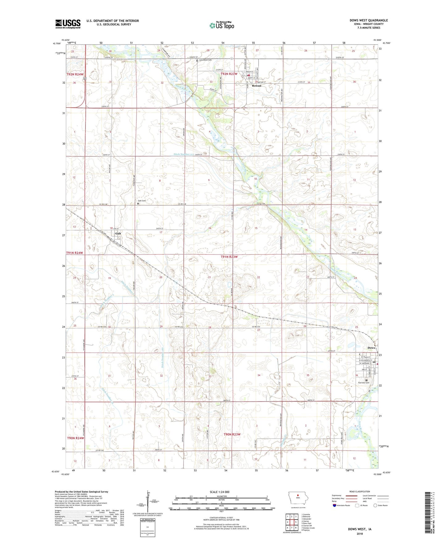
2022 topographic map quadrangle Dows West in the state of Iowa. Scale: 1:24000. Based on the newly updated USGS 7.5' US Topo map series, this map is in the following counties: Wright. The map contains contour data, water features, and other items you are used to seeing on USGS maps, but also has updated roads and other features. This is the next generation of topographic maps. Printed on high-quality waterproof paper with UV fade-resistant inks.
Quads adjacent to this one:
West: Clarion
Northwest: Cornelia
North: Belmond
Northeast: Alexander
East: Dows East
Southeast: Popejoy
South: Sheldon Creek
Southwest: Clarion SW
This map covers the same area as the classic USGS quad with code o42093f5.
Contains the following named places: Bingham Park, City of Dows, City of Galt, City of Rowan, Ditch Number 187, Ditch Number 213, Ditch Number 55, Ditch Number 7, Dows, Dows Ambulance Service, Dows Care Center, Dows City Hall, Dows Clinic - Franklin Medical Center, Dows Elementary School, Dows Fire Department, Dows Park, Dows Post Office, Dows Public Library, Dows Welcome Center, Fairview Cemetery, First Lutheran Church, Fryeburgh Post Office, Galt, Galt Cemetery, Galt Post Office, Graceland Cemetery, Groom Area, Gun Club Corner, Horse Grove - Rietz Forest Area, Methodist Church, Otisville Post Office, Prairie Smoke Wildlife Area - Central Unit, Prairie Smoke Wildlife Area - East Unit, Presbyterian Church, Quasdorf Wagon Machine and Blacksmith Shop Museum, Rowan, Rowan City Hall, Rowan Fire Department, Rowan Post Office, Rowan Public Library, Township of Blaine, United Church of Rowan, Vernon Number Five Country School, ZIP Codes: 50071, 50470