MyTopo
Corning North Iowa US Topo Map
Couldn't load pickup availability
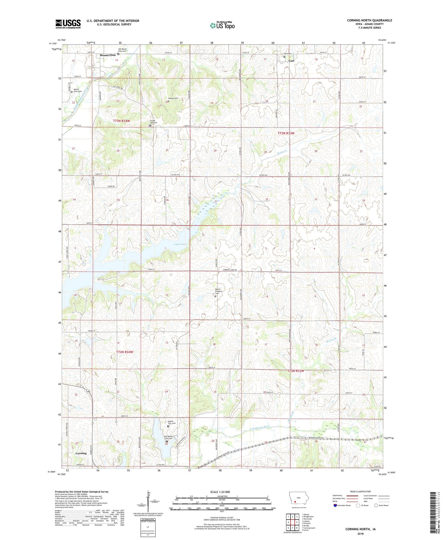
2022 topographic map quadrangle Corning North in the state of Iowa. Scale: 1:24000. Based on the newly updated USGS 7.5' US Topo map series, this map is in the following counties: Adams. The map contains contour data, water features, and other items you are used to seeing on USGS maps, but also has updated roads and other features. This is the next generation of topographic maps. Printed on high-quality waterproof paper with UV fade-resistant inks.
Quads adjacent to this one:
West: Carbon
Northwest: Dewey
North: Bridgewater
Northeast: Nevinville
East: Prescott
Southeast: Lenox
South: Corning South
Southwest: Brooks
This map covers the same area as the classic USGS quad with code o41094a6.
Contains the following named places: Adams County, Brown Branch, Carl, Carl Cemetery, Carl Methodist Church, Carl Post Office, Forest Hill Cemetery, Grace Baptist Church, Homan Cemetery, Lake Binder, Lake Icaria, Lake Icaria County Recreation Area, Lakeview Campground, Mount Etna, Mount Etna Cemetery, Mount Etna Church of the Brethren, Mount Etna Post Office, Mount Etna Quarry, Mount Pleasant Cemetery, Mount Washington Post Office, Old Mount Etna Cemetery, Old Queen City Cemetery, Queen City, Queen City Cemetery, Timber Ridge Campground, Township of Carl, Township of Prescott