MyTopo
Bridgewater Iowa US Topo Map
Couldn't load pickup availability
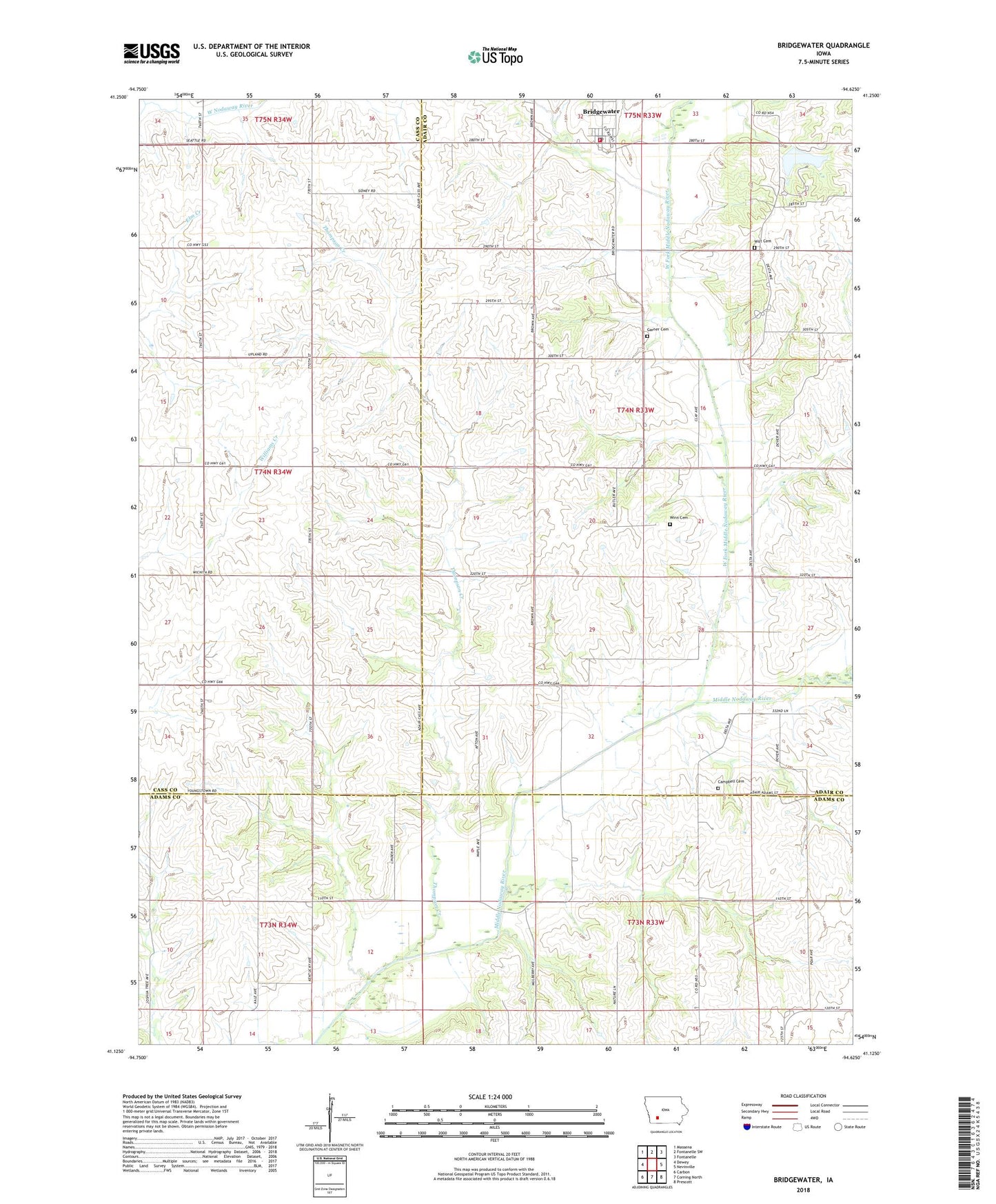
2022 topographic map quadrangle Bridgewater in the state of Iowa. Scale: 1:24000. Based on the newly updated USGS 7.5' US Topo map series, this map is in the following counties: Adair, Cass, Adams. The map contains contour data, water features, and other items you are used to seeing on USGS maps, but also has updated roads and other features. This is the next generation of topographic maps. Printed on high-quality waterproof paper with UV fade-resistant inks.
Quads adjacent to this one:
West: Dewey
Northwest: Massena
North: Fontanelle SW
Northeast: Fontanelle
East: Nevinville
Southeast: Prescott
South: Corning North
Southwest: Carbon
This map covers the same area as the classic USGS quad with code o41094b6.
Contains the following named places: Bridgewater, Bridgewater Fire Department and Emergency Medical Services, Bridgewater Post Office, Camp Eo-wa-ta, Campbell Cemetery, City of Bridgewater, Garner Cemetery, Morman Trail County Park, Morman Trail Lake Dam, Mormon Trail Lake, Thompson Creek, Township of Washington, Trinity Christian Church, United Methodist Church, West Fork Middle Nodaway River, Winn Cemetery, Witt Cemetery, ZIP Code: 50837