MyTopo
Corning South Iowa US Topo Map
Couldn't load pickup availability
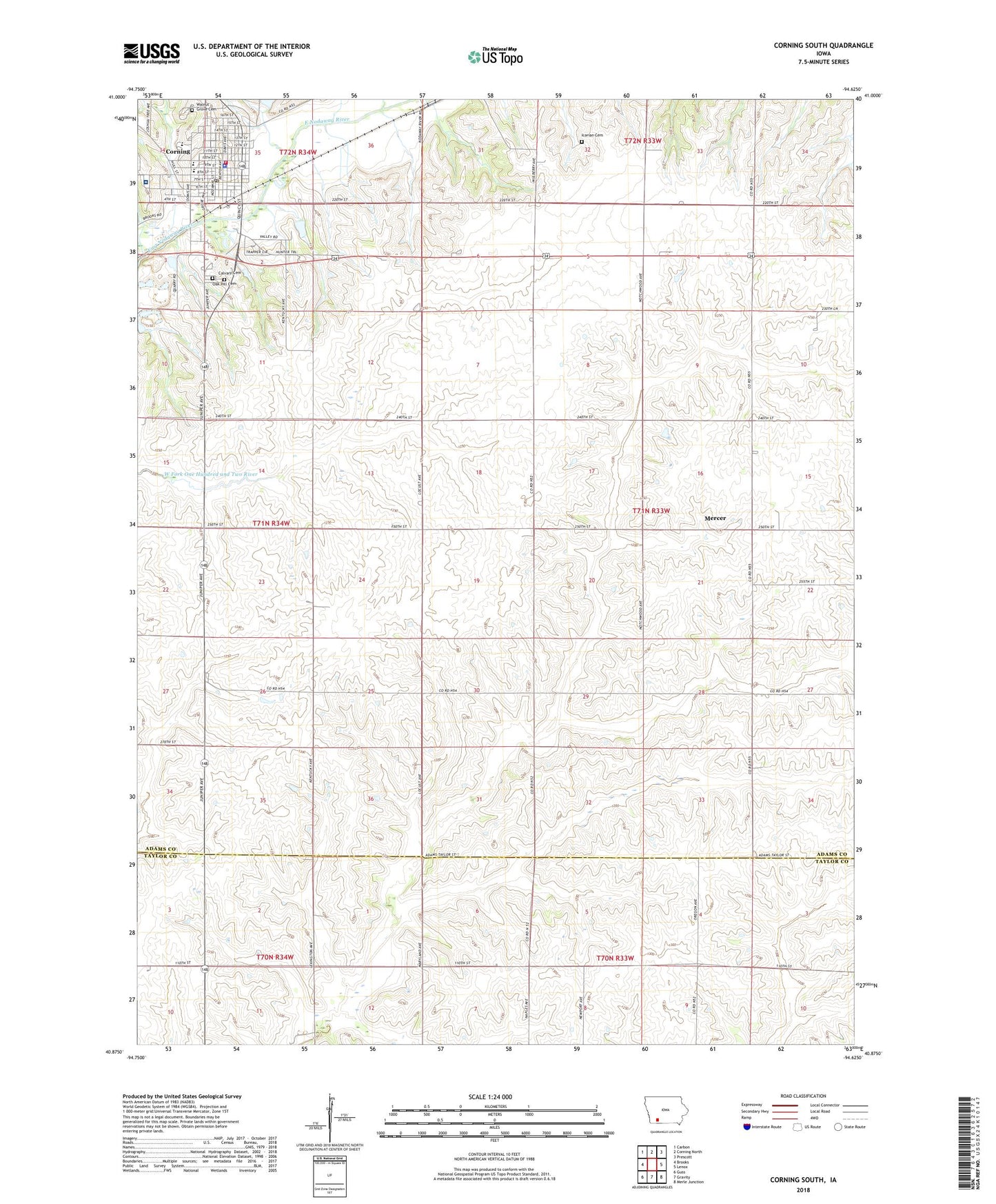
2022 topographic map quadrangle Corning South in the state of Iowa. Scale: 1:24000. Based on the newly updated USGS 7.5' US Topo map series, this map is in the following counties: Adams, Taylor. The map contains contour data, water features, and other items you are used to seeing on USGS maps, but also has updated roads and other features. This is the next generation of topographic maps. Printed on high-quality waterproof paper with UV fade-resistant inks.
Quads adjacent to this one:
West: Brooks
Northwest: Carbon
North: Corning North
Northeast: Prescott
East: Lenox
Southeast: Merle Junction
South: Gravity
Southwest: Guss
This map covers the same area as the classic USGS quad with code o40094h6.
Contains the following named places: Adams County Courthouse, Adams County Fairgrounds, Adams County Home, Adams County House of History, Adams County Sheriff's Office, Adams County Speedway, Alegent Health Clinic, Calvary Cemetery, Catholic Health Initiatives Health Mercy Corning Medical Center, Central Park, City of Corning, Corning, Corning Christian Church, Corning City Hall, Corning City Public Library, Corning Elementary School, Corning Family Chiropractic Center, Corning Fire Department, Corning Junior High School, Corning Nursing and Rehabilitation Center, Corning Police Department, Corning Post Office, Family Vision Center, First Presbyterian Church, Grace Tabernacle Assembly of God Church, Grove Park, Happy Hollow Country Club, Holt, Icarian Cemetery, Icarid, Lonzo Creek, Mercer, Mercer Church, Mercer Post Office, Oak Hill Calvary Cemetery, Queen City Post Office, Redeemer Lutheran Church, Saint Patricks Roman Catholic Church, Southwest Valley High School, Spring Lake Park, Township of Mercer, United Methodist Church, Walnut Grove Cemetery, Willow Creek