MyTopo
Guss Iowa US Topo Map
Couldn't load pickup availability
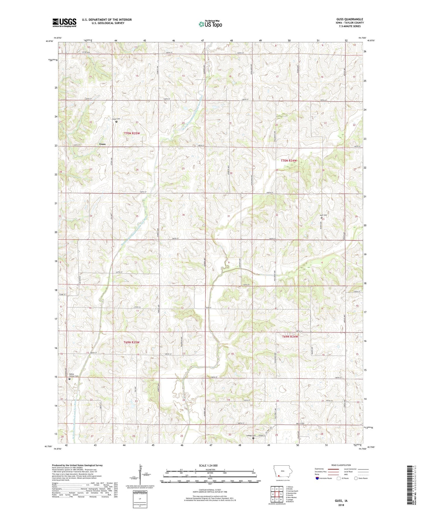
2022 topographic map quadrangle Guss in the state of Iowa. Scale: 1:24000. Based on the newly updated USGS 7.5' US Topo map series, this map is in the following counties: Taylor. The map contains contour data, water features, and other items you are used to seeing on USGS maps, but also has updated roads and other features. This is the next generation of topographic maps. Printed on high-quality waterproof paper with UV fade-resistant inks.
Quads adjacent to this one:
West: Hawleyville
Northwest: Villisca
North: Brooks
Northeast: Corning South
East: Gravity
Southeast: Bedford
South: Ladoga
Southwest: New Market
This map covers the same area as the classic USGS quad with code o40094g7.
Contains the following named places: Bycroft Landing Field, Dallas Center Cemetery, Gravity Post Office, Guss, Guss Cemetery, Guss Post Office, Holt, Holt Cemetery, Holt Post Office, Ladoga Cemetery, Maple Grove Church, Middle Branch One Hundred and Two River, Rose Branch, Township of Dallas, Township of Holt, Township of Nodaway, Township of Washington, ZIP Code: 50848