MyTopo
Corwith Iowa US Topo Map
Couldn't load pickup availability
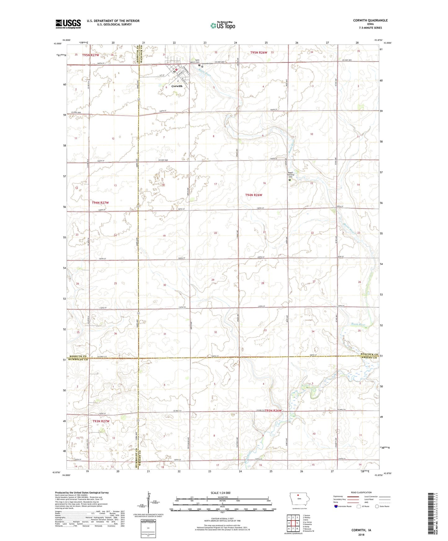
2022 topographic map quadrangle Corwith in the state of Iowa. Scale: 1:24000. Based on the newly updated USGS 7.5' US Topo map series, this map is in the following counties: Hancock, Wright, Kossuth, Humboldt. The map contains contour data, water features, and other items you are used to seeing on USGS maps, but also has updated roads and other features. This is the next generation of topographic maps. Printed on high-quality waterproof paper with UV fade-resistant inks.
Quads adjacent to this one:
West: Lu Verne
Northwest: Sexton
North: Wesley
Northeast: Britt
East: Kanawha
Southeast: Kanawha SE
South: Renwick
Southwest: Hardy
This map covers the same area as the classic USGS quad with code o42093h8.
Contains the following named places: Aldrich, City of Corwith, Corwith, Corwith - Wesley High School, Corwith Cemetery, Corwith Emergency Medical Technicians, Corwith Post Office, Corwith Public Library, Corwith Town Hall, Corwith Volunteer Fire Department, East Branch Boone River, Gold-Eagle Cooperative Elevator, Grace Baptist Church, Magor Township Cemetery, Saint Johns Lutheran Church, Saint Marys Cemetery, Township of Magor, United Methodist Church, ZIP Code: 50430