MyTopo
Sexton Iowa US Topo Map
Couldn't load pickup availability
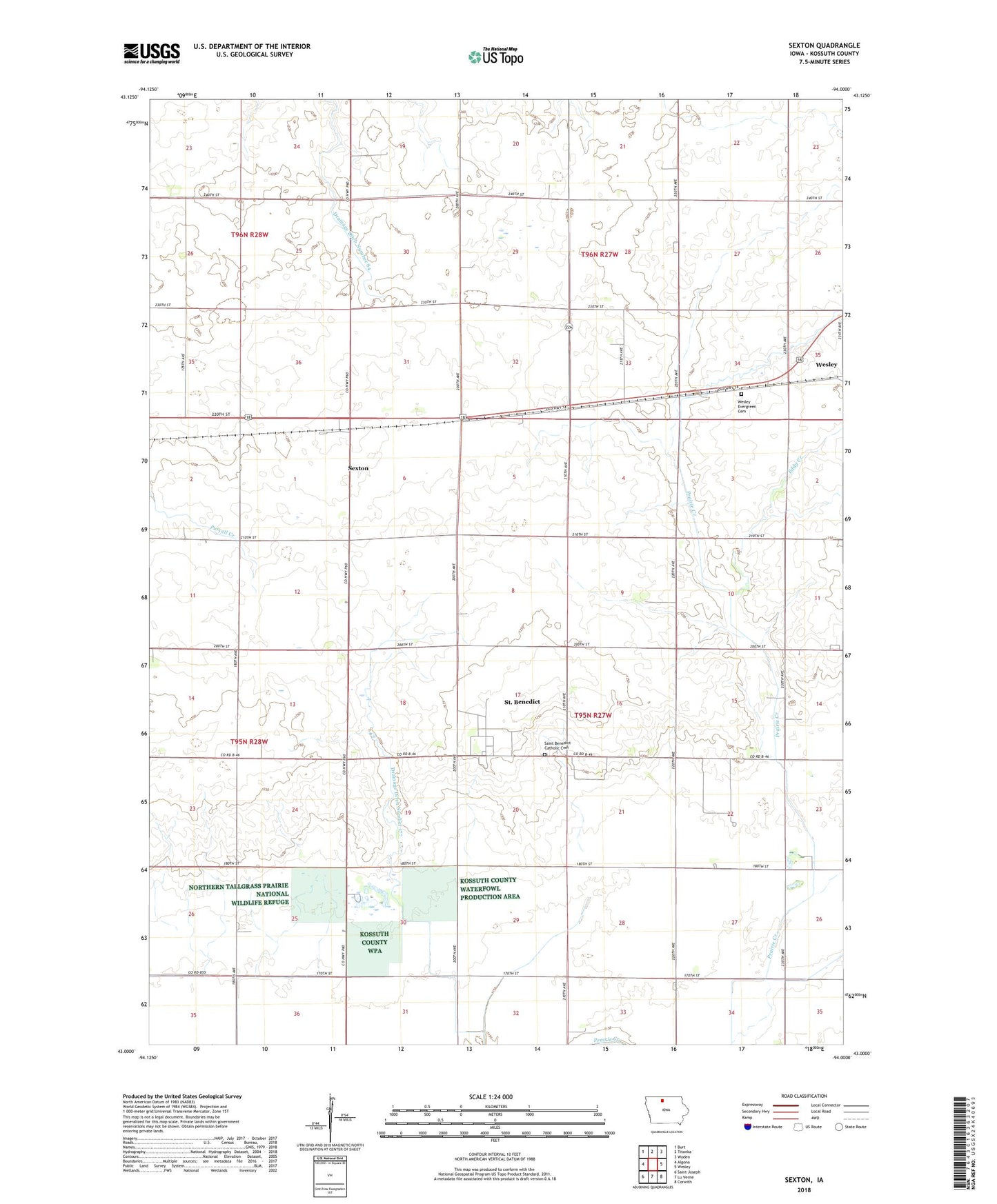
2022 topographic map quadrangle Sexton in the state of Iowa. Scale: 1:24000. Based on the newly updated USGS 7.5' US Topo map series, this map is in the following counties: Kossuth. The map contains contour data, water features, and other items you are used to seeing on USGS maps, but also has updated roads and other features. This is the next generation of topographic maps. Printed on high-quality waterproof paper with UV fade-resistant inks.
Quads adjacent to this one:
West: Algona
Northwest: Burt
North: Titonka
Northeast: Woden
East: Wesley
Southeast: Corwith
South: Lu Verne
Southwest: Saint Joseph
This map covers the same area as the classic USGS quad with code o43094a1.
Contains the following named places: Drainage Ditch Number 177, Drainage Ditch Number 84, Eddy Creek, Evergreen Cemetery, Rahm Post Office, Saint Benedict, Saint Benedict Catholic Cemetery, Saint Benedict Census Designated Place, Saint Benedict Post Office, Saint Benedict Wildlife Area, Saint Benedicts Church, Sexton, Sexton Census Designated Place, Sexton Post Office, Township of Prairie, ZIP Code: 50483