MyTopo
Wesley Iowa US Topo Map
Couldn't load pickup availability
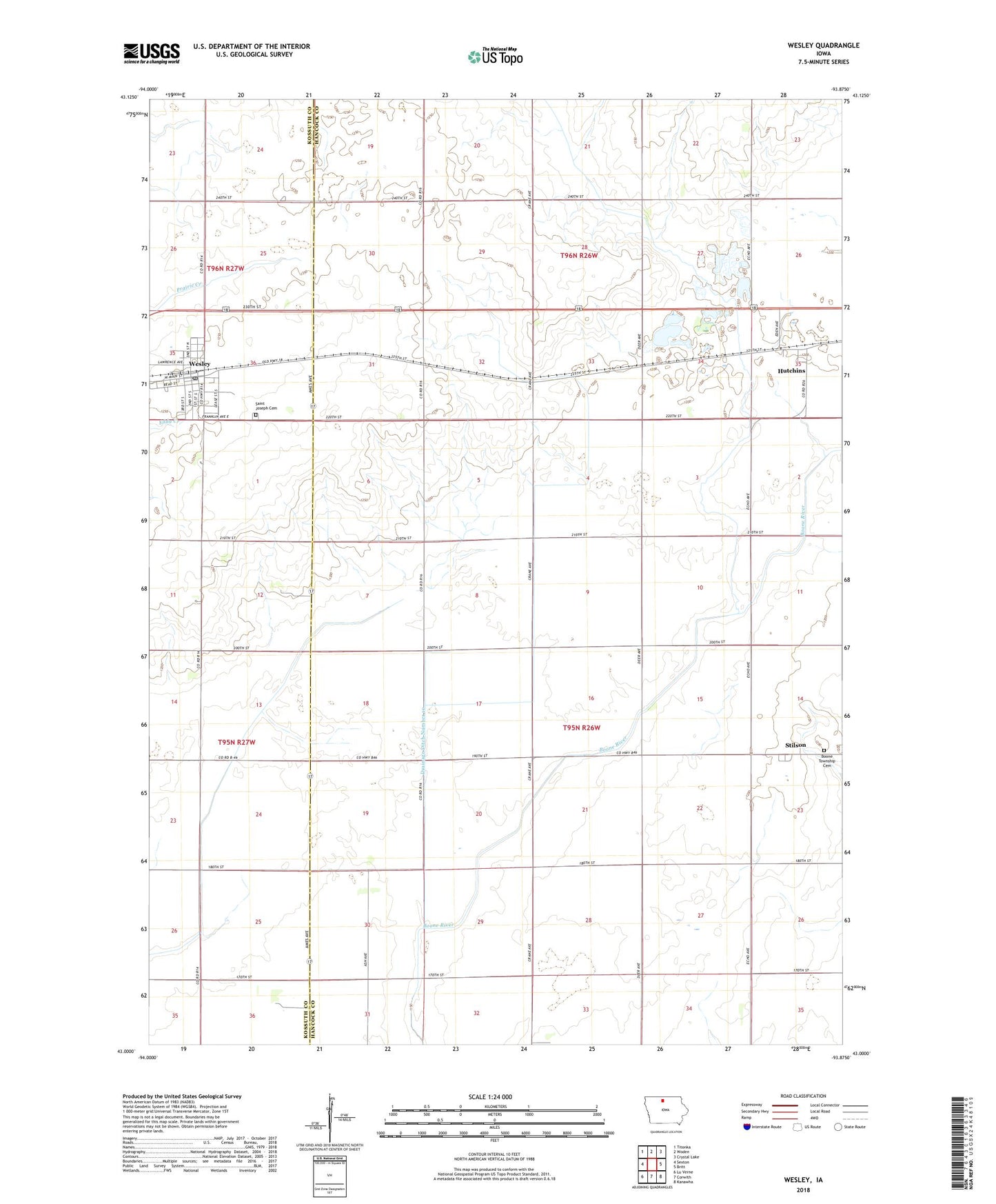
2022 topographic map quadrangle Wesley in the state of Iowa. Scale: 1:24000. Based on the newly updated USGS 7.5' US Topo map series, this map is in the following counties: Hancock, Kossuth. The map contains contour data, water features, and other items you are used to seeing on USGS maps, but also has updated roads and other features. This is the next generation of topographic maps. Printed on high-quality waterproof paper with UV fade-resistant inks.
Quads adjacent to this one:
West: Sexton
Northwest: Titonka
North: Woden
Northeast: Crystal Lake
East: Britt
Southeast: Kanawha
South: Corwith
Southwest: Lu Verne
This map covers the same area as the classic USGS quad with code o43093a8.
Contains the following named places: Boone Township Cemetery, City of Wesley, Drainage Ditch Number 10, Evangelical Free Church, Farmers Co-op Society Elevator, Hillside Golf Club, Hutchins, Hutchins Census Designated Place, Hutchins Post Office, Newbrough Airport, Saint Joseph Cemetery, Saint Joseph's Catholic Church, Stilson, Stilson Post Office, Township of Boone, United Methodist Church, Wesley, Wesley City Hall, Wesley Elementary School, Wesley First Responders, Wesley Landing Strip, Wesley Medical Clinic, Wesley Post Office, Wesley Public Library