MyTopo
Depew Iowa US Topo Map
Couldn't load pickup availability
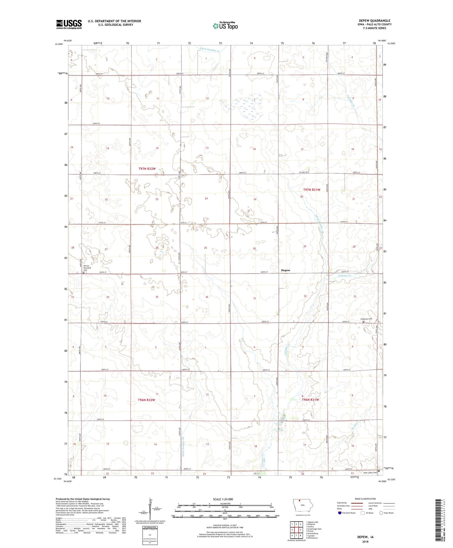
2022 topographic map quadrangle Depew in the state of Iowa. Scale: 1:24000. Based on the newly updated USGS 7.5' US Topo map series, this map is in the following counties: Palo Alto. The map contains contour data, water features, and other items you are used to seeing on USGS maps, but also has updated roads and other features. This is the next generation of topographic maps. Printed on high-quality waterproof paper with UV fade-resistant inks.
Quads adjacent to this one:
West: Graettinger East
Northwest: Ingham Lake
North: Ringsted
Northeast: Seneca
East: Fenton
Southeast: Whittemore
South: Cylinder
Southwest: Emmetsburg
This map covers the same area as the classic USGS quad with code o43094b5.
Contains the following named places: Bruch Side Farms, Depew, Depew Post Office, Ditch Number 15, Ditch Number 28, Ditch Number 80, Saint Johns Lutheran Cemetery, Saint Johns Lutheran Church, Saint Johns Lutheran North Cemetery, Sportsman County Park, Township of Fairfield, Township of Freedom, Township of Independence, Township of Vernon, Vernon Township Cemetery, ZIP Code: 50528