MyTopo
Ringsted Iowa US Topo Map
Couldn't load pickup availability
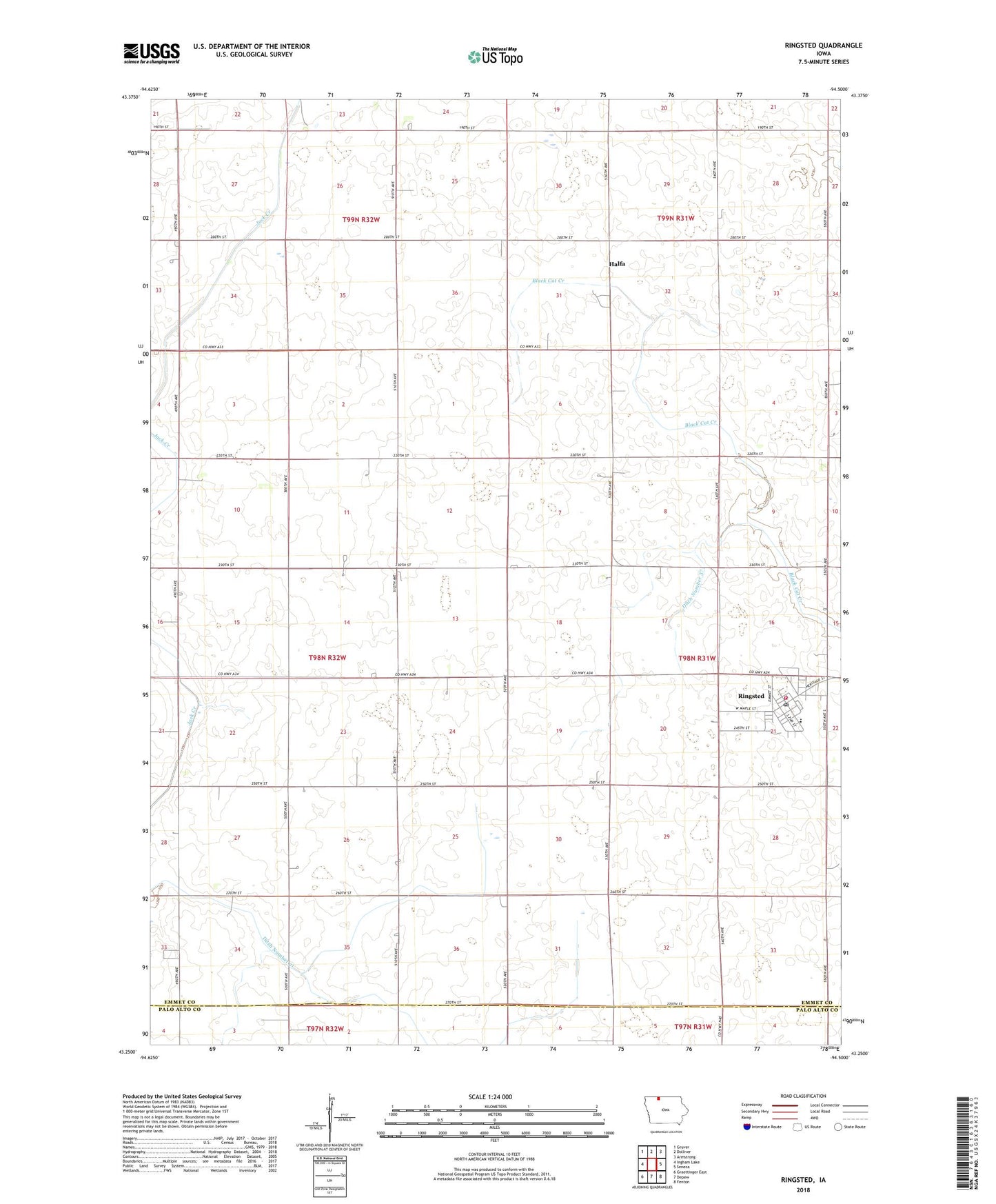
2022 topographic map quadrangle Ringsted in the state of Iowa. Scale: 1:24000. Based on the newly updated USGS 7.5' US Topo map series, this map is in the following counties: Emmet, Palo Alto. The map contains contour data, water features, and other items you are used to seeing on USGS maps, but also has updated roads and other features. This is the next generation of topographic maps. Printed on high-quality waterproof paper with UV fade-resistant inks.
Quads adjacent to this one:
West: Ingham Lake
Northwest: Gruver
North: Dolliver
Northeast: Armstrong
East: Seneca
Southeast: Fenton
South: Depew
Southwest: Graettinger East
This map covers the same area as the classic USGS quad with code o43094c5.
Contains the following named places: Armstrong - Ringsted Elementary School, City of Ringsted, Co-op Grain and Product Company Elevator, Ditch Number 21, Ditch Number 37, Halfa, Halfa Post Office, Hoprig, Hoprig Post Office, J and N Farm, Luke Farm, M and R Farms, Peltz Field, Presbyterian Church, Ringsted, Ringsted City Hall, Ringsted Fire Department, Ringsted Post Office, Ringsted Public Library, Saint Pauls Lutheran Church, State Line Co-op Elevator, State Line Cooperative Elevator, Township of Denmark, Township of Jack Creek, ZIP Code: 50578